The UK planning system remains a source of frustration for anyone using it. Some of this is down to the system itself, as reflected in last summer's King's Speech, in which the government recognised that reform is key to providing the housing that the UK needs while also stimulating economic growth.
However, delays are not solely due to navigating the legacy system, but also stem from the significant manual effort required both by those submitting and those processing applications. This involves tasks such as evaluating the likelihood of approval by local planning authorities and entering plans into various online portals.
With the increased availability of geospatial data, many of these planning assessments can now be automated, though, significantly reducing the time needed to submit, update or amend applications.
Access to register informs planning applications
The technology to transform the planning system has been available for some time. However, a persistent challenge in the sector has been accessing fit-for-purpose geospatial data, which is crucial for supporting automation.
Data-sharing capability and policy changes now coming into play, such as revisions to the National Planning Policy Framework that encourage standardisation in definitions, could help to resolve these problems.
Programmes such as the National Underground Asset Register (NUAR) show how these capabilities can be exercised. The NUAR saves maintenance teams significant time by having a single source of information for all underground assets, letting them plan ahead before excavating sites or completing maintenance tasks underground and preventing them from striking utility assets.
The register is made up of data supplied by asset owners from hundreds of organisations across the UK, ranging from utilities to local government authorities, a process commonly known as data ingestion.
At 1Spatial, we created a data transformation and ingestion process using our own platform to convert the supplied data into the NUAR format, using the Open Geospatial Consortium (OGC) Model for Underground Data Definition and Integration (MUDDI) standard.
A continuous stream of data is required to ensure that the register remains current and accurate, giving maintenance teams confidence when using it to plan maintenance and excavation works. We have automated the ingestion process, allowing it to be scaled up for an increasing number of NUAR users.

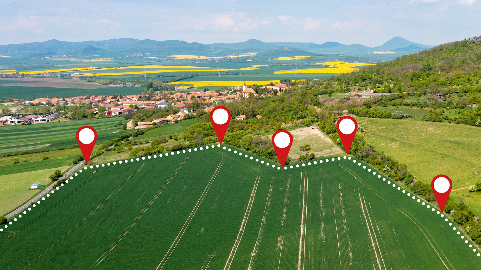
Figure 1: 1Spatial software shows geospatial data captured during field surveys
Automated assessments can guide investment decisions
Asset registers such as NUAR offer core reference data that enables users to test the viability of sites for development or proposed planning ideas.
At 1Spatial, we have built tools to make viability assessments of land for potential development more efficient by using the data in asset registers such as NUAR and other sources. The user enters information about the chosen area and their planned project; for example, three detached houses that are two storeys high.
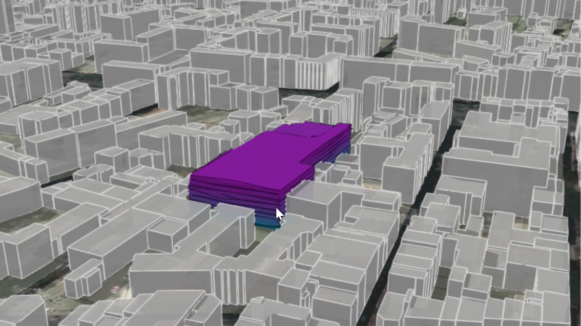
The algorithms then read the various asset registers and automatically produce 3D models showing the space available for development on that plot that complies with legislation, such as line-of-sight restrictions.
This automation produces a result in seconds, helping developers assess whether a plot of land is worth purchasing or whether development restrictions may prevent a significant return on investment.
'At 1Spatial we have built tools to make viability assessments of land for potential development more efficient by using the data in asset registers such as NUAR'

Figure 2: Screenshot of 1Spatial's solution using automation to show build capability of a new plot of land
Tool developed to infer location of utility assets
However, it's possible that the data required to support these algorithms may still not be available. In that case, the technology can plug the gap with inferred data, although users should remember this will not have been accurately surveyed.
One instance where we have used automation for this purpose has been water pipes. The 1Spatial pipe inference software was developed to deal with waste water after United Utilities (UU) selected the firm to help with its data cleansing strategy. Typically, organisations cleanse data when it is not meeting their operational needs, and the process could range from data quality audits to archiving legacy data to reduce operational overheads.
The first stage of collaboration was linear asset management (LAM), to consolidate all UU's asset records and corresponding locational data into a single database. This detailed the way various linear assets such as water mains and sewers connected with point assets including water treatment works, valves and water outlets.
At the same time, UU wanted a more complete record of various attributes such as particular pipes' age, diameter and material. To achieve this, 1Spatial ran a series of workshops to identify user requirements and the different sources of data, essentially breaking down the organisation's historic data silos and quantifying gaps.
Together, 1Spatial and the UU team ran further workshops to derive a series of inference rules to fill these gaps using the experience of the utility's engineers and such data as was available. Over time, as field engineers carry out their normal duties, inferred data can be replaced by confirmed data.
As the project progressed, legislation was passed to improve the management and maintenance of private sewers by transferring responsibility to water utility companies, implemented under the Water Industry (Schemes for Adoption of Private Sewers) Regulations 2011. Many miles of private sewers had never been mapped before, so during the LAM project a technique was devised to infer the position of these.
Some of UU's engineers estimated the probable location based on their experience. This gave a rough idea, but was impossible to validate against actual survey data. To create a more accurate and individually verifiable model, 1Spatial and UU developed rules using known information such as the age, size and type of properties across the catchment.
These rules inferred the type and location of private sewers for each address, which could subsequently be validated by observation. Applying this logic, UU became one of the only water companies with a fully mapped private sewer network.
With greater access to data and our improved ability to infer what is missing, automation is thus becoming part of the planning process, reducing the reliance on slower, resource-heavy manual processes.

