Christ The Reedeemer Statue and Sugar Loaf Mountain, Rio de Janeiro, Brazil
Every day, an average of 5,000 people visit the statue of Christ the Redeemer at the peak of Mount Corcovado in Rio de Janeiro, Brazil, a deeply religious symbol and tourist hotspot on countless bucket lists.
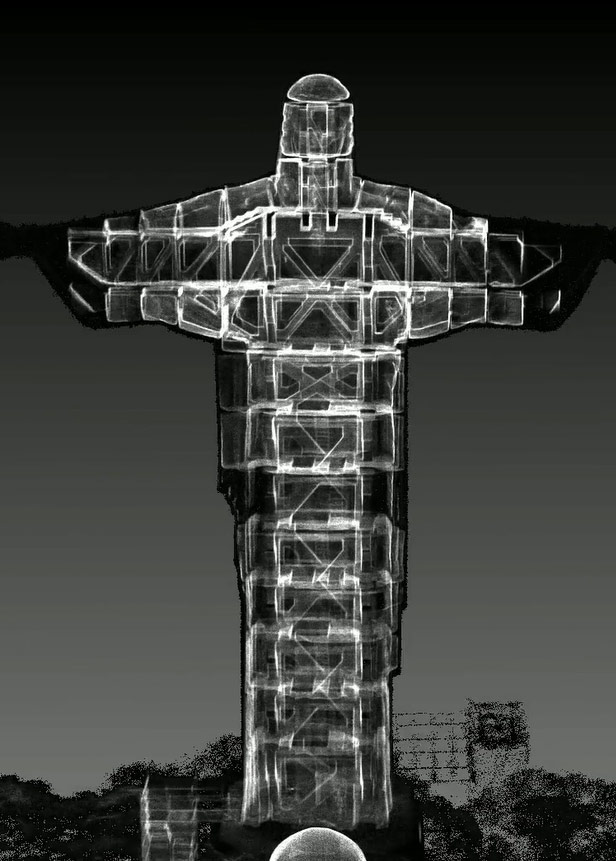
Since the statue’s construction in 1931, the interior has been hidden from view, with only a select few maintenance teams, artists and journalists having access to the staircase inside. For years, the internal structure has been closed to the public – until now.
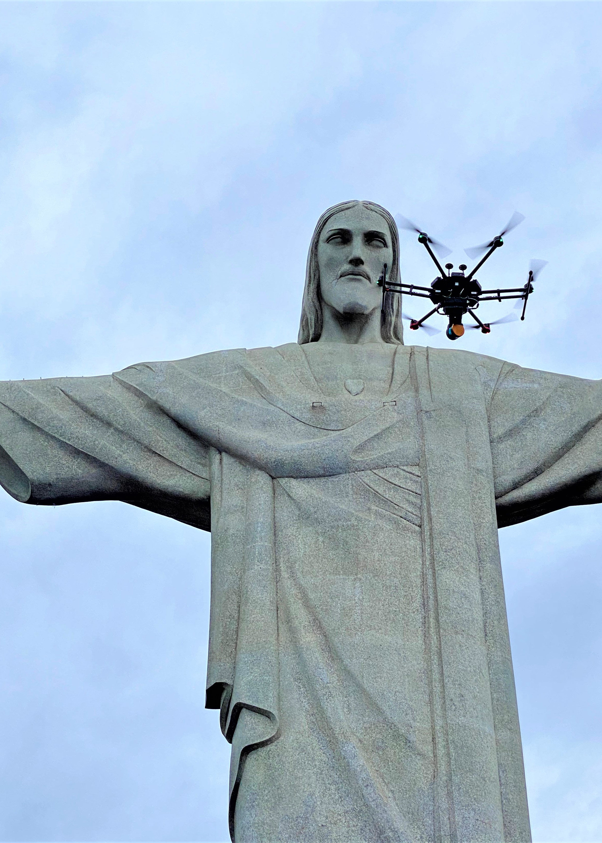
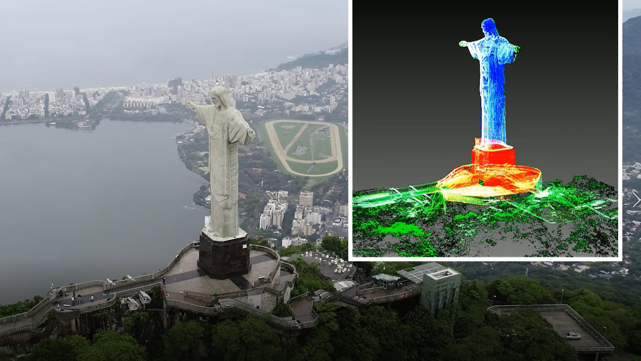
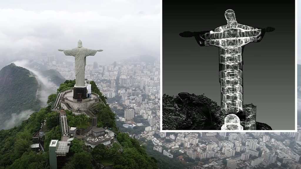
The historic statue has recently been opened up and reimagined in digital form to understand its structure before it is restored. Images and videos use the latest simultaneous localisation and mapping (SLAM) and uncrewed aerial vehicle (UAV) technology to reveal the inside of the monument.

Weathering the storm
Created by French sculptor Paul Landowski and built by Brazilian engineer Heitor da Silva Costa, the statue is emblematic of the city of Rio and spans 28m wide, with its arms extending over the Guanabara Bay and the Tijuca Forest beneath.
The statue, which towers more than 700m above sea level, will be 90 years old in October this year. Over the years, it has been exposed to all types of weather, leaving a lasting impact on its body. In 2008 and again in 2014, lightning strikes damaged parts of the statue, dislodging a finger and scorching the back of the head.
To complete the SLAM scan before restoration, the summit of Mount Corcovada was temporarily closed to the public, allowing the surveying team to work the site with minimal disruption. Using the SLAM processing software a range of tools allowed simple registration of point cloud data, including alignment of multiple scans and geo-referencing using spherical targets to recreate the statue in digital form.

Surmounting the challenges
For project manager Gabriel de Praxedes, this was the job of a lifetime – but anything worth having never comes easy. On an initial site recce to do some pre-flight checks. The first challenge was predicting the weather. Because of its height, the summit has its own microclimate. While it could be clear and dry on the ground, at the peak it was often considerably different.
The second challenge was the various levels of the subject – from its base and outstretched arms, to the narrow, winding staircase leading to the top of its head – that had to be mapped out so the survey could be carefully planned. The team needed to ensure the technology would be up to the task.

De Praxedes says: 'The GeoSLAM ZEB Horizon allowed me to map the statue from the base of the summit with its handheld walk-and-scan functionality, all while producing the data in real time.' He added: 'It's a lightweight yet robust piece of equipment, so I could move freely around the subject and navigate the staircase inside while still recording the finer details. The weather was not a problem either as the device's LiDAR works in all conditions, and the SLAM algorithm can identify features even in fog or low light.'
Accessing the difficult-to-reach parts of the statue was simple as well, because the ZEB Horizon can easily be fitted to a UAV to record the dimensions accurately from up to 100m away.

Swift work on site
Mapping from the inside out was completed in 45 minutes, and a series of 3D scans containing more than 180m points was created from the data collected, producing a digital twin of the monument. While on site, the team processed the data through GeoSLAM Hub, software that enables surveyors to transform 3D data into useable information, recording the statue in a totally new light.
The benefit of reviewing the data on site in a location such as this cannot be underestimated. With the space closed to the public for only a short period, the team had to work as quickly as possible to meet the statue’s on-site requirements to collect all the information they needed before the attraction reopened.
If the team had noticed any missed areas in the scan or errors once they had left the site, it would have meant returning and re-recording the data – an inconvenience and unnecessary expense. But as GeoSLAM data can be reprocessed if needed, the team were confident they had everything they needed. Reprocessing is useful for data collected in challenging environments. A suite of advanced processing parameters can help users reduce scan drift – in open environments – remove outlying data points and prioritise planar surfaces in noisy environments.
Graham Hunter is chief executive officer at GeoSLAM
Contact Graham: LinkedIn
Related competencies include: Measurement, Remote sensing and photogrammetry, Surveying and mapping
