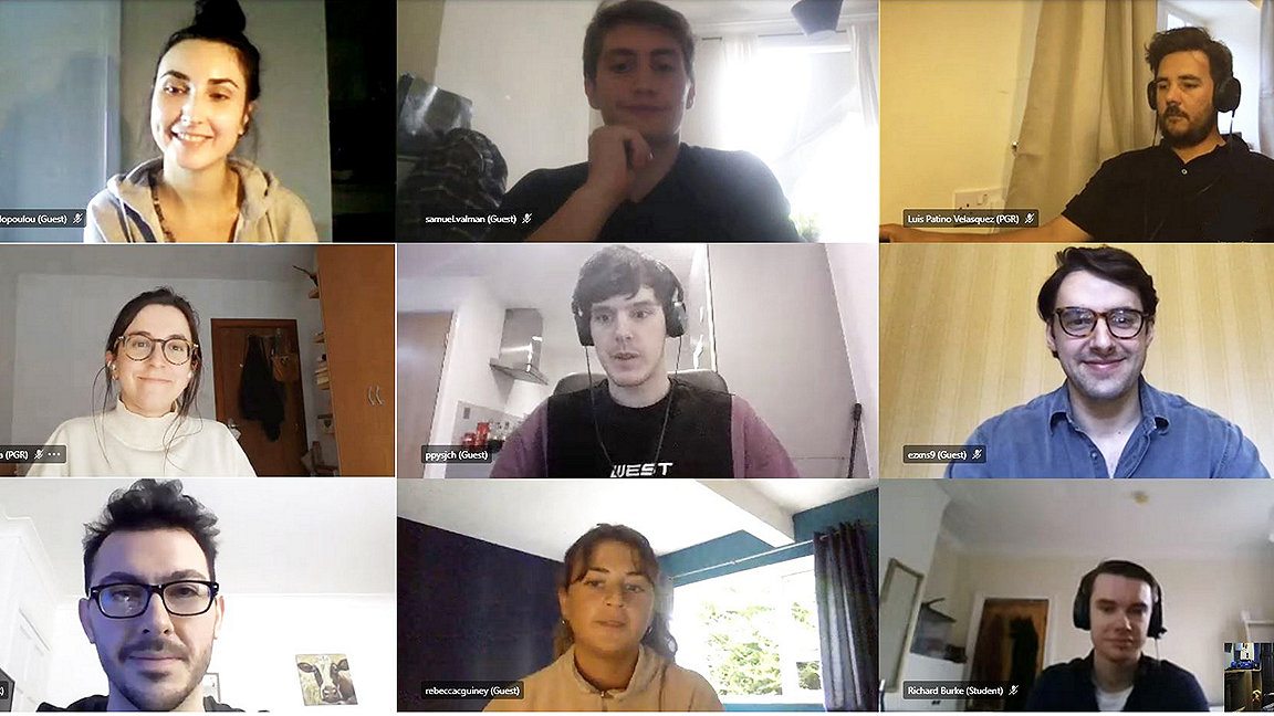
Newcastle University and the University of Nottingham established a dedicated doctoral training centre for the geospatial professionals of the future. Students and tutors managed to continue during lockdown.
LJ: What is the background to this collaboration to train the next generation of geospatial engineers and scientists?
Stuart Marsh: It goes back a long way. Jon Mills from Newcastle and I worked together in the late 1990s. At the time I worked at the British Geological Survey (BGS) and we co-supervised a few PhD students which BGS part-sponsored at Newcastle on various things to do with geospatial science particularly coastal erosion and how that was affecting heritage sites.
When I joined the Nottingham Geospatial Institute in 2013 I had already been collaborating both with Newcastle University and the University of Nottingham; but the two organisations did not work together much, so when an opportunity arose to establish a centre for doctoral training I said yes, of course, and worked on developing the bid with them.
While developing the bid, the creation of a UK Geospatial Commission was announced, which gave us an anchor in government policy. The government effectively said 'We need more people with geospatial skills,' and that's exactly what the centre was about. Our bid to the Engineering and Physical Sciences Research Council (EPSRC) was eventually successful, and we received a substantial amount – around £7m – to set up the Centre for Doctoral Training (CDT) in Geospatial Systems.
LJ: How are you going to spend the money?
SM: The money is there to support 40 PhD students who each take a four-year course. The first year is an MRes in geospatial data science, which is followed by a three-year PhD involving interdisciplinary research.
The 40 candidates will be appointed over a five-year period. We're currently two and a half years in, so about half way. Anna Klimkowska and David Alvarez Castro are students from the first cohort, while we've just appointed a third cohort who will start in September. It's a production line of what we hope will be the next generation of geospatial talent.
David and Anna started in 2019. It's a substantial programme of around 20 EPSRC students at each university, and we hope to appoint one more at either institution every year, funded by industry. So in total there will be about ten additional industrial studentships over the lifetime of the centre. That's where Max Wilkinson comes in, as he works on partner engagement.
At the moment we have a couple of PhD candidates on such studentships funded by Ordnance Survey (OS), Anna being one, and we've also got someone funded by the UK Defence Science and Technology Laboratory. One of the third cohort will be funded by the UK Hydrographic Office. So, we're doing well at getting industrial studentships, but we need to keep that momentum going.
During the pandemic, securing the funding has been more difficult as organisations seem more reticent to commit and many are also using this unusual time to take stock of their external activities. They are happy to collaborate, but it's been a challenge to talk about funding studentships.
'We're doing well at getting industrial studentships, but we need to keep that momentum going'
Max Wilkinson: I'm the industry liaison for the CDT at the universities. I get academia and industry together to identify synergies between the centre's research and the requirements of business, to develop mutually beneficial partnerships.
The CDT's remit is to fill the skills gap in the geospatial profession, and so effective partnerships with industry are key to providing graduates with the correct knowledge and experience to hit the ground running in their new roles.
LJ: Anna, what's your specialism?
Anna Klimkowska: I am a surveyor who started studying geospatial for my master's in geodesy and cartography at the Warsaw University of Technology, Poland. My main interests are in photogrammetry, earth observation methods and GIS. I have diverse academic and industrial experience from my work in Poland, the UK and South Korea over the past decade.
Throughout this, I have focused on data quality and application. During my research, I had a chance to compare images with optical scanner data in recreating a helicopter rotor-wing shape. I used satellite radar imagery to assess land motion caused by oil production, and trace sea vessels from optical and thermal sensors mounted on a drone.
In the industry, I worked as a GIS specialist in a telecommunication company on spatial data analysis and map creation. I then continued my GIS work at the Polish Geological Institute–National Research Institute, being responsible for database management and the production of thematically diverse geological maps.
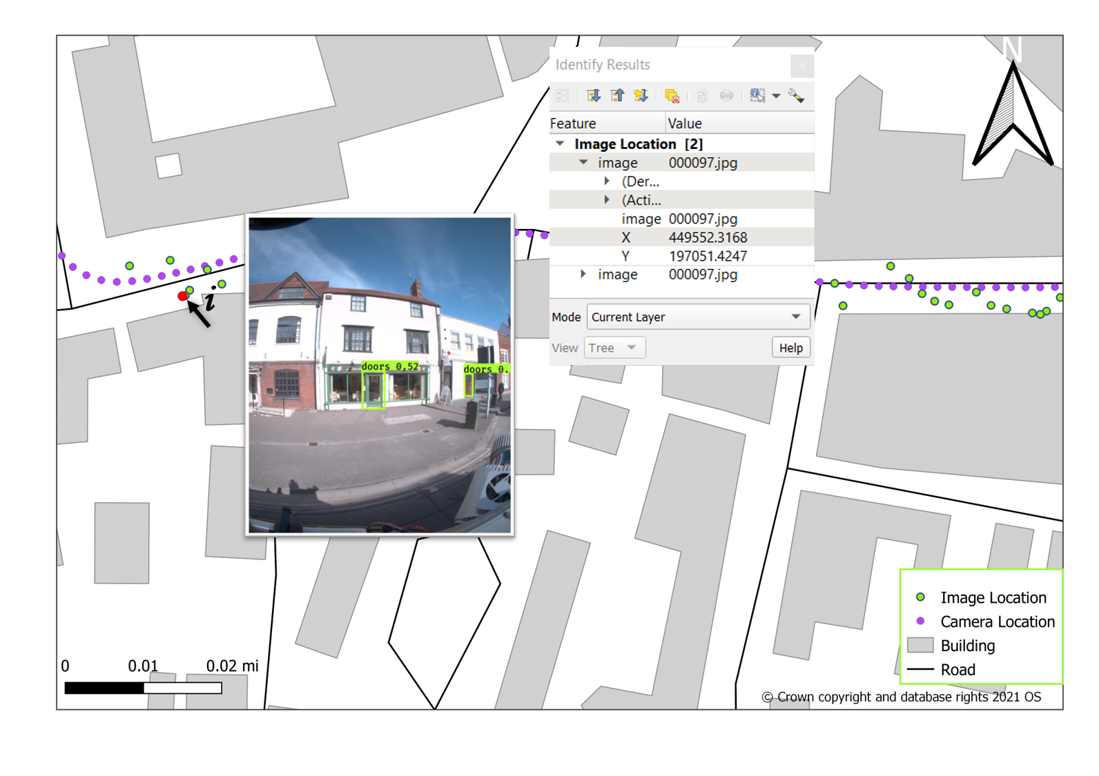
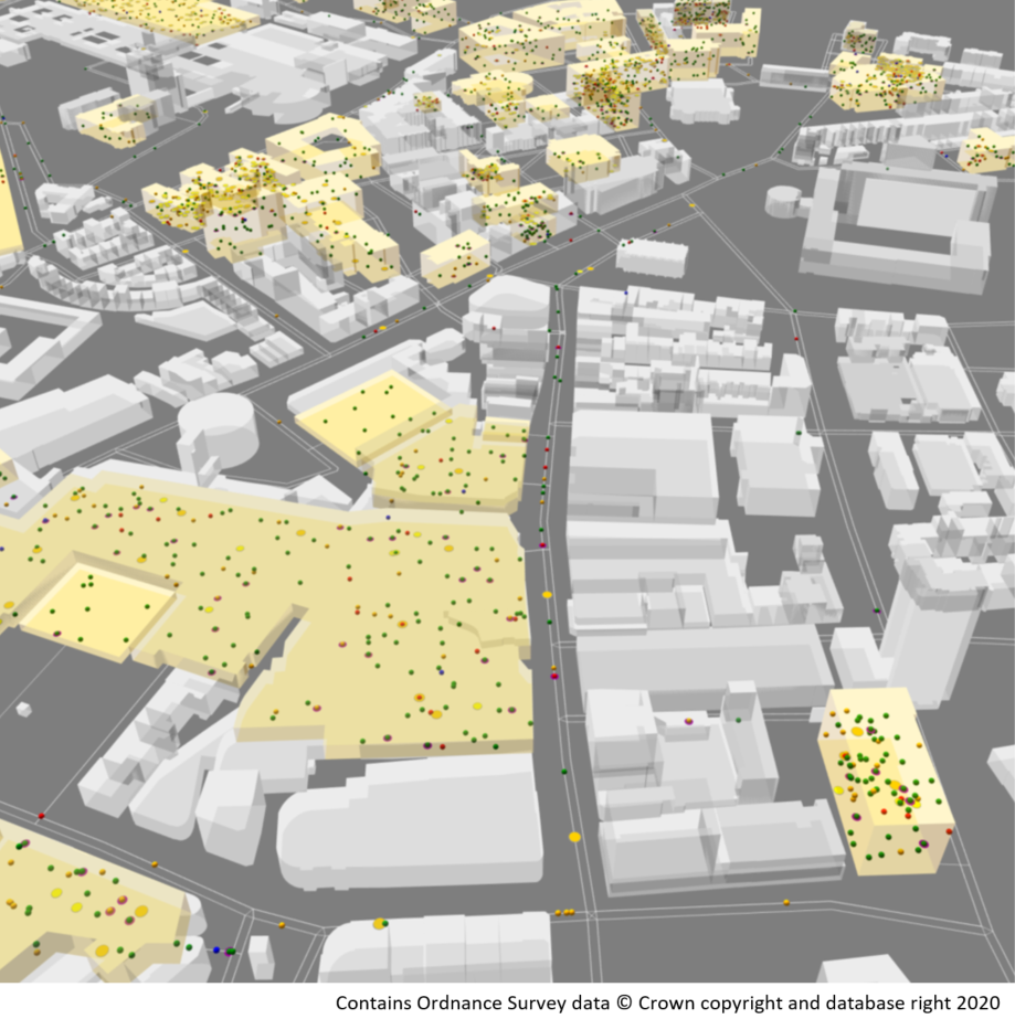
Last year, I started studying at CDT, where I work on a project fusing 3D on complex environments, sponsored by the OS. The project's main goal is to use different kinds of sensor to enrich building models with openings such as windows and doors. Several potential applications could benefit from more detailed models such as this, including emergency response services, mobility for people with disabilities, or estimation of solar energy potential.

Being at the CDT is a unique opportunity for me as a PhD student. From the beginning, we are part of something bigger: we have other students with whom we can share our experience and learn something new and we get support from other CDT members, supervisors and industrial partners in understanding what geospatial is on many different levels.
David Alvarez Castro: I am a surveyor in engineering from the Technical University of Madrid, with a master's in cartography and geodesy. I have a diverse background in the geospatial field, working for different companies in the UK and Ireland over the past seven years.
I started working as a land surveyor in Ireland scanning on site, among other functions. Then I moved to the UK and worked as a BIM processor, handling point-cloud data and developing 3D models of railway stations and bridges, and making CAD drawings of network utilities. After that, I worked as a GIS specialist, developing and testing geospatial tools to identify risks to electrical assets from the proximity of vegetation.
Last year I joined the CDT and did a master's in geospatial data science. It was a great opportunity to develop my knowledge and skills using geospatial data sets and improve techniques in fields such as data management, machine learning and data visualisation. As a result, I analysed COVID-19 transmission between students and the efficiency of simulated restrictions, including face masks, lockdown and self-isolation.

Currently, I am in the early stages of my PhD, which will take a geospatial perspective on reducing greenhouse gas emissions from the transport sector, simulating different urban mobility scenarios in Newcastle.
I agree with Anna about the opportunity offered by being part of the CDT. The support of members, the supervisory team and partners will allow all students to achieve our goals during our PhD work.
LJ: Why is it an exciting time for geospatial?
SM: I think it's making a transition from being a specialised subject, which only a few people knew about, to become more ubiquitous. Everyone is now using a bit of geospatial.
For instance, with Google Maps incorporating satellite imagery, people can access satellite views on their phones. Earth observation data has become part of our everyday lives in a way it never was before. You see it on the weather forecast, which shows the satellite view and explains what that means. It's becoming normalised.
When I said I was going to do a PhD in earth observation data I was the only one in my entire year, and I knew most of the other geospatial PhD candidates around the world because we'd met at conferences. Now it's much more common that a researcher will want to use a bit of geospatial to answer a question.
The data requires less pre-processing than it used to. When I did my PhD, even getting it into a form that you could analyse made up 90% of a project. Now we've probably got that down to 20%, so there's a lot more time for the analysis.
Over time it's being used more, for different applications and by people who are much less specialised. This does not just mean engineers and geographers. People in the business school have set up a neo-demographics laboratory using different geomatics approaches to provide data on people and places that they don't already have, for instance from developing countries.
Then the physics department is using geospatial data and techniques in modelling systems behaviour, while computer science has developed a lot of the clever algorithms we now use to automate processes. In civil engineering and in architecture and the built environment, people interested in the way cities are designed might use thermal remote sensing data to understand urban temperatures better, for instance.
LJ: How can surveyors get involved in the work of the centre?
MW: We have various opportunities for surveyors to partner with the CDT, which vary according to the level of commitment. We welcome in-kind engagement with the CDT through guest lectures, typically as part of our industry seminar series. This is a good opportunity for our students to network with professionals and to hear for themselves about the techniques used day to day, and how solutions to distinctive challenges are developed and implemented.
Further in-kind engagement opportunities include attendance at our annual assembly in August and our innovation festival in April. Both events provide a forum for CDT researchers to interact with professionals, to present their research and to discuss opportunities for collaboration. For professionals this is in turn an opportunity to introduce their organisation and to meet our researchers directly.
Our challenge week in September is a chance for professionals to set a problem for the CDT. Our students then work in groups to develop a solution over the course of the week. Industry typically supports this event by providing access to data sets and technical expertise to guide our students.
We also welcome offers of industry internships for our students. Each undertakes a placement in industry of between one and three months, the cost of which is supplemented in part by their research training and support grant. The internships can be distinct from their research in the CDT, so this is an opportunity for them to gain industry experience while identifying their transferable skills and competencies.
At a higher level of commitment, we welcome direct sponsorship of PhD studentships. Doing so allows industry to collaborate closely with the CDT to address specific challenges, using the latest research techniques and expertise. The requirements of the industrial partner are specified at the start of the project, and so remain front and centre in the research undertaken.
In terms of recruitment, we have been recruiting for the PhDs in fairly traditional places. We'd like to diversify, though, and there are opportunities for people who might have worked for five years or so in a related discipline but would now like to do something different or take their skills further. There’s also the opportunity for industry to upskill through the CDT and so we encourage land surveying professionals to apply.
Prof. Stuart Marsh is CDT director at the University of Nottingham
Contact Stuart: Email | LinkedIn
Max Wilkinson is enterprise & outreach facilitator for the CDT in Geospatial Systems, based at Newcastle University
Contact Max: Email | LinkedIn
Related competencies include: Geographic Information Systems (GIS), Research, Surveying and mapping
