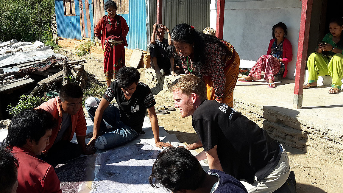
Jordan Friis, a VCS in Nepal, 2017, © Jordan Friis
Land Journal: What are the aims of the Volunteer Community Surveyor Program (VCSP)?
Claire Buxton: The VCSP is run by the International Federation of Surveyors (FIG) Young Surveyors Network (YSN), which comprises around 11,000 professionals aged up to 35 or within ten years of graduating from a BA or MA.
It allows young surveyors to volunteer their time and skills. Our motto is: 'We map the world a better place'. We bring our combined global energy to two of the most important issues that our generation is fighting: the climate crisis, and the lack of equal access to land rights.
Our vision is that, by 2024, the VCSP will be a respected and sustainable way of connecting skilled young surveyors with causes such as land rights for all and combating environmental crises.
Our commitment is to enable young surveyors to volunteer on projects that prepare them for the world, both in their professional and personal lives, by learning different perspectives and allowing them to connect, promote and share knowledge with others.
Our purpose is to have a positive impact on the environment and help people in need at community, country and global levels, to ensure our common future.
How did the programme develop?
CB: We started in 2015 with a conversation. Eva-Maria was YSN chair at the time, and she launched a pilot of the programme that ran in 2017 and then 2018. This saw 13 young surveyors deployed around the world with Global Land Tool Network (GLTN), an alliance of international partners that promotes land rights for all. The network's mission is to create a world in which everyone enjoys secure land rights.
Israel Taiwo was one of the volunteer surveyors on the pilot, which was a success. I then ran a workshop in New Zealand on a similar theme – for all surveyors, not just young ones – to connect them with opportunities to volunteer, mostly in the Pacific islands and territories. And in 2019 I created a four-year strategy for the YSN, and we're just about to start year two of that.
LJ: Can you describe the benefits, challenges and outcomes of volunteering with VCSP?
Israel Taiwo: In 2018 I was deployed as a volunteer community surveyor (VCS) to the Pader district of Uganda, where there was an NGO called Uganda Community-Based Association for Women and Children's Welfare (UCOBAC).
I'm glad I applied to support that project because it's different to the land management system that I'm familiar with from Nigeria. This UCOBAC project was much more about customary land rights: finding a way to recognise people's rights to land. I took over from a previous VCS and carried on where she left off, providing some technical surveying expertise, helping to train local people who had limited knowledge of land rights and GLTN resources.
Besides training workers, we were also involved in documentation. I interviewed some of the stakeholders, including the community head, local government officials, and applicants who came to register their land. One interesting piece of feedback was that the registration process in which the VCSP was involved will help to eliminate or reduce the possibility of land disputes that had previously characterised the Pader district.
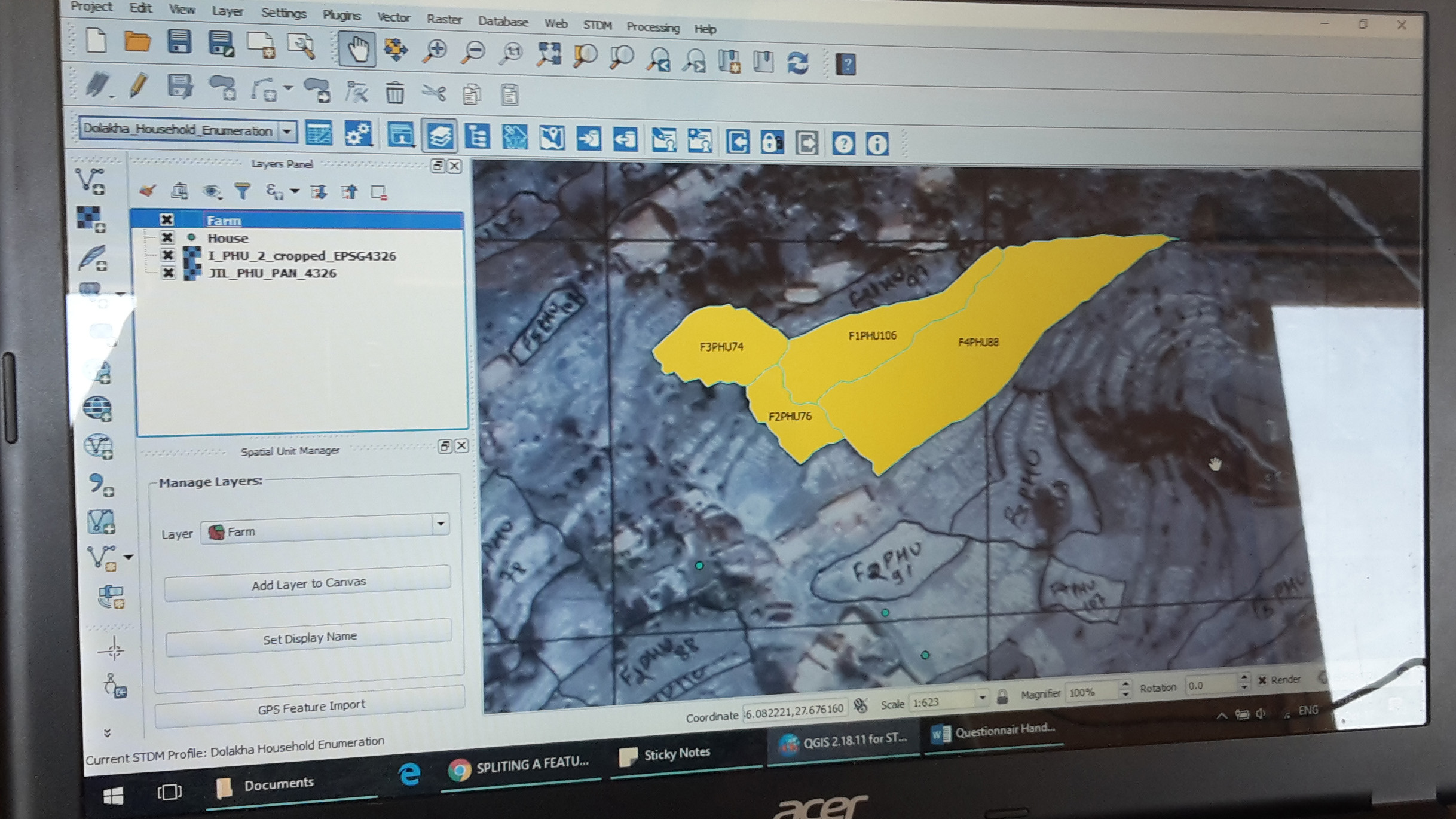
In this rural context, when two parties with contiguous boundaries came together, we used handheld GNSS receivers to acquire coordinates that were then plotted on an orthophoto, for everyone to see the boundaries they had agreed. Pictures, videos and texts were used to document experiences of the processes and feedback from the community.
Another particularly interesting case concerned women's land rights. In Nigeria – which has a similar culture to Uganda – it's largely assumed that men rather than women have rights to land. I spoke to a Ugandan man who had four or five wives, and he had decided to register all his land in their names so that when he dies each of them and their children will know what they will inherit and there will be no disputes. I especially enjoyed working on that.
Because this was the first time I'd worked on a project outside Nigeria I could say I had worked in an international context for three weeks, which is one of the benefits for volunteers on the programme.
CB: We have so much feedback from the pilot saying that volunteers' leadership and communication skills developed, and their assumptions and biases have been challenged so they've grown as people. You can hear some volunteers talking about their experiences on YouTube.
LJ: And Israel, how did you continue to work with VCSP?
IT: An opportunity came up to lead the Wisdom Workshop, which this year was in the form of a webinar. We ran a week-long open course online beforehand to prepare volunteers for in-country deployment, which Tim Burch mentioned in his article. This gave participants some background on the VCSP and the tools, so the workshop itself could be used for the practical sessions and not to answer questions that could be researched beforehand.
The theme of the Wisdom Workshop was sustainable solutions for land-based community problems. Day one included sessions on community problems, land tenure and tools for land management, and day two focused on building capacity and implementing modern land management approaches.
One of the concepts taught during the workshop was Fit-for-Purpose Land Administration. This is something everyone champions, but there is a need for people who understand the concept to apply it or guide its implementation. Other concepts taught include the continuum of land rights, the impact of land insecurity on citizens, and the skills of a humanitarian surveyor.
Two major partners gave hands-on practical training in how to use their tools, Cadasta and GLTN. Other partners that helped run workshop sessions included Spatial Collective, and Land Equity International.
CB: The point of the Wisdom Workshops is not to teach young surveyors every detail, but rather to alert them to the potential challenges they will face outside their usual environment and the tools they can add to their kit as humanitarian surveyors.
Normally, deployments are in other countries, but this time they are in the same country because of the pandemic. Despite this, we are still committed to giving young surveyors the opportunity to experience different cultures and customs. The wisdom ensures that they don't say: 'This is the way we do things and you must do it this way.' Understanding local customs and the benefits of drawing on local knowledge is much more effective than a top-down approach.
The workshops fill a massive gap, so that young surveyors used to a more rigid landownership system are exposed to the idea that not everyone holds land rights in a documented way. The workshops can highlight tools for recording any undocumented land, to avoid land grabbing or disputes.

LJ: How can people get involved with VCSP?
CB: There are various different paths:
- in-country deployment
- Wisdom Workshops
- e-volunteering.
- knowledge portal
- partnerships with mapping NGOs, donors, and the surveying community
- communications.
E-volunteering was introduced because there are many different types of surveyor, and not all may focus on land rights. And there are lots of young surveyors who may not be able to take six weeks off work and travel around the world, so this is another way for them to give their time.
We've had one e-volunteering event, in conjunction with the Surveying and Spatial Sciences Institute in Australia, which mapped static water infrastructure to tackle last year's bush fires in the country. We collected the data over 24 hours, with 400 participants in 37 countries.
The purpose of this mapathon was to collect data that could be used in the future to train AI to do so at a much faster rate. It gives firefighters the information they need to find water sources more promptly, and means they are more prepared for future bush fire seasons. Interviews with stakeholders about how the data was used are available on YouTube.
We're working on running another 24-hour mapathon for the FIG Working Week event in June to show what can be done with e-volunteering . We're always looking for opportunities to volunteer, and have connections with OpenStreetMap (OSM) and Missing Maps. We're also very aware of MapAction, as well as various other organisations that share our passion for using mapping and data to help fight the climate crisis. We're concentrating on data analysis and having our young surveyors trained to validate for OSM.
LJ: What does the future look like?
CB: Sustainability is not only about the environment, and we want to ensure that the programme itself is sustainable. We introduced the knowledge portal as a central place for volunteers, young surveyors or anyone interested in humanitarian surveying to find resources, either so they could prepare for in-country deployment or to research various tools and look at country profiles from previous volunteers and local experts. The knowledge portal is our way of sustaining the VCSP beyond our current team, to pass on what we've learned about running the programme.
When we had our four-year strategy approved by the FIG board last year, we had intended to do three workshops, two in-country deployment programmes and three volunteering events over four years. We want to keep the momentum going, so I wouldn't be surprised if we do more. However, we are all volunteers, so it depends on the time and money we have available. We do need more funding and donors.
LJ: How can people contact you?
CB: To get involved, go to our website. It's not just for young surveyors – we need VCSs as well as VCS mentors. The landing page has links to donate and sign up to our mailing list, and we also advertise opportunities through our social media pages.
Anyone interested in partnering or funding can also contact us directly. There are lots of ways people can support the programme, by supplying kit for instance. We've just had confirmation that industrial technology company Trimble has donated some Catalyst global navigation satellite system units for future deployments, which is great.
Claire Buxton is Core Team Lead for VCSP and a project manager and party chief for Underhill Geomatics in Vancouver
Contact Claire: Email | LinkedIn
Israel Taiwo is the VCSP Wisdom Workshops lead and a lecturer in the Department of Surveying and Geoinformatics of the Federal Polytechnic Ado-Ekiti, Nigeria
Related competencies include: Cadastre and land administration, Legal/regulatory compliance, Surveying and mapping
