Photographer: Tolga Ildun/Shutterstock
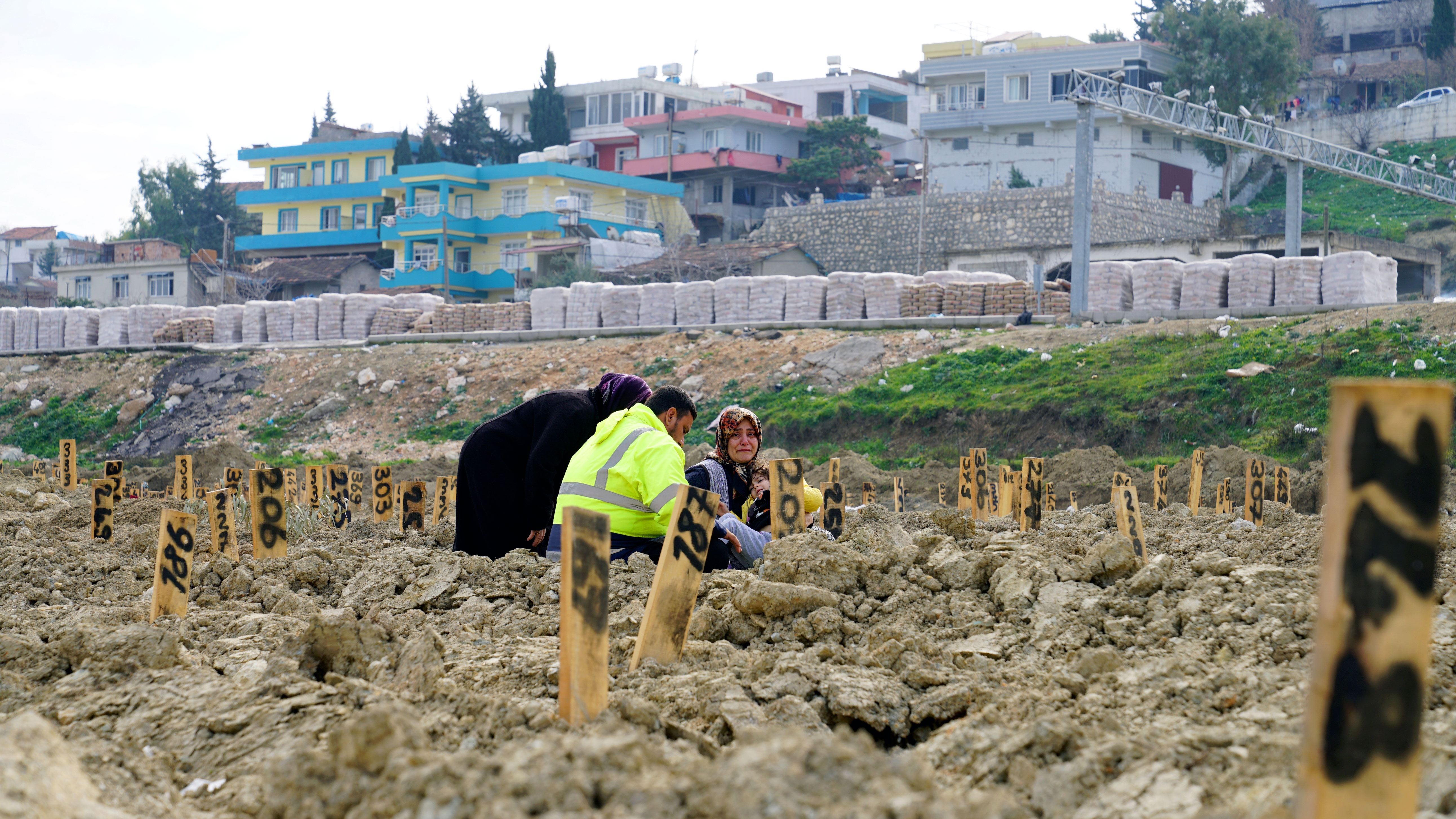
Within 24 hours of the devastating 7.8-magnitude earthquake that struck Kahramanmaras province in south-east Türkiye on 6 February, a field team of three MapAction volunteers set off for Gaziantep – less than 20km from the epicentre – to map the disaster landscape and the current situation. Many more contributed remotely, channelling their efforts through the field team.
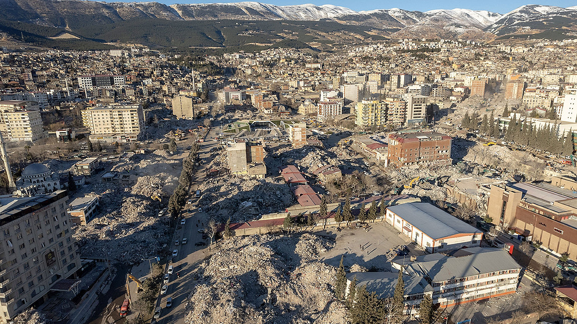
Natural disasters such as this render many previous maps redundant; yet relief agents urgently need to understand the geography of the disaster area, as well as mapping incoming data to get a clearer understanding of the transformed landscape.
The first people to respond are always next-door neighbours, local organisations and national governments. However with a disaster on this scale it's common for the host government to call in specialist UN support.
Volunteers coordinate emergency mapping
When the UN or a regional disaster agency gets that call, MapAction's is one of the numbers in their speed dial. In Türkiye, for example, the UN Disaster and Assessment Coordination (UNDAC) office requested a team from the UK-based group of geographers and geospatial experts within hours of the earthquake striking Kahramanmaras. A few hours later, a team of three experienced MapAction volunteers was ready to deploy to Türkiye, and within a day they were on their way.
What exactly does MapAction do in these circumstances? 'We try to collate as much information as possible – as it is changing by the minute – to understand what's happened, where people have been worst affected or displaced to. Then we try to map that information so the relevant authorities can move into the worst-affected areas and try to prioritise where they go,' Alice Goudie, a volunteer who first worked on the Türkiye response, told BBC Good Morning Scotland from Gaziantep.
MapAction maintains a highly skilled team of around 70 volunteers, usually working in geographical and data professions, who are trained in supporting humanitarian emergency response. Within hours we checked the availability of the whole team to see who could jump on a plane, because when it comes to urban search and rescue, then minutes matter.
There is never a shortage of volunteers; only of funds. MapAction always wants to respond to every emergency. If relief agencies understand the status of roads, transport infrastructure, radio stations, hospitals, pharmacies, clinics and open schools, for example, they can make sure people aren't left behind.
Over 20 years, in 137 emergency deployments in 80 countries as well as hundreds of disaster preparedness events, the charity has provided international relief agencies, governments and grassroots organisations with maps and data to make the vital decisions that affect vast numbers of people. Where should emergency aid go first, and how? If people are displaced, what routes are open to reach them?

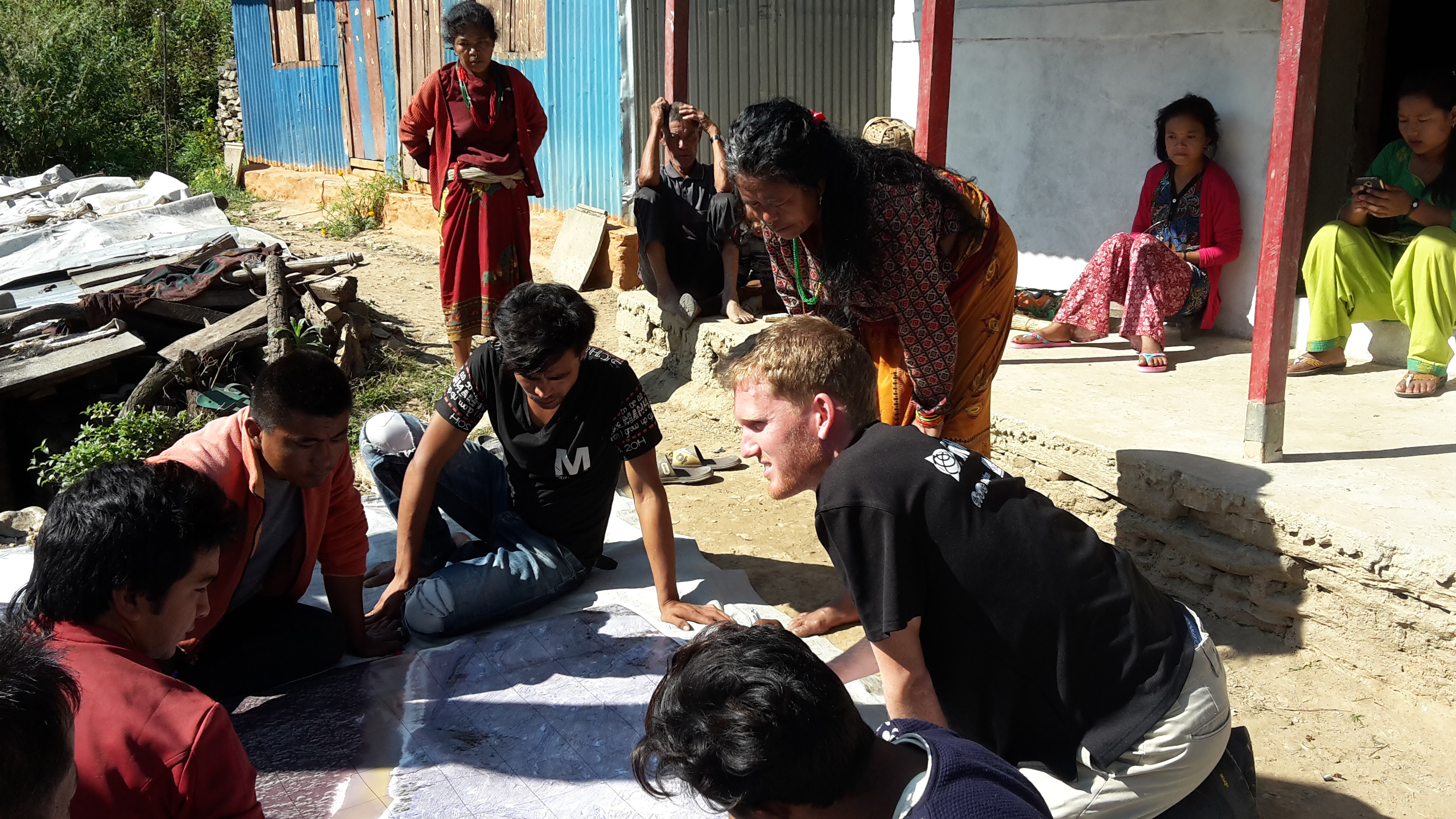
MapAction volunteers working on floods in Kinshasa, Democratic Republic of Congo, December 2022. Photographer: Alistair Wilkie, © MapAction

Hatay, Türkiye, February, 2023. Major damage caused by the earthquake in Antakya. Photographer: Hasan Akbas/Shutterstock
Why maps are vital in a crisis
Some of the many maps the team has so far produced in Türkiye and Syria have covered everything from average forecast temperatures in affected areas to shake intensity by administrative area or the location of temporary camps. Others have focused on collapsed buildings and population density in quake-hit areas.
Each map is created to help decision-makers act more quickly and accurately. Some maps are key to search-and-rescue operations – knowing where to send rescue personnel, which areas have been searched and which have not. Other maps might help plot a path for emergency aid to those who need it most, using the fastest and most accessible routes.
The number of natural disasters has nearly doubled since the 1980s, with an average of 412 a year between 2010 and 2020 according to UN data, while climate change is increasing the need for emergency response. The effects are also often more extreme and occur much faster: hunger, displacement, conflict.
'There's never been a greater need for the work that MapAction does. But ironically it has come at a time when funding for specialist agencies such as ours is becoming harder to find,' says MapAction income director Ian Davis.
'We spend too little to qualify for the big disaster appeals and government grant allocations, but we still need to spend. We recently launched an appeal to pay for this response and the ones that will inevitably happen later this year and next. That appeal must succeed so that we can continue to answer the call,' Davis adds.
Aside from the struggle to raise sufficient funds, the organisation is adapting to the challenge of more emergencies by supporting disaster preparedness and creating greater resilience at local level. MapAction's experience in humanitarian geospatial data and mapping supports innovative approaches, such as identifying early warning signals that can make the whole humanitarian sector more efficient.
Once trigger points are passed that indicate an imminent food or refugee crisis, funding can be released and aid readied in advance. This helps communities to stay intact, and also helps markets, services and systems to function.
'Some maps are key to search-and-rescue operations – knowing where to send rescue personnel, which areas have been searched and which have not'
How you can support MapAction
As climate change is forcing the emergency response sector to adapt, there continues to be pressing demand for the work MapAction does. Even seismic activity could be linked to the changing climate.
'Recent studies have proposed a causal link between rising sea level during periods of warming climate, and increased frequency of volcanic eruptions and earthquakes,' notes Dr Lorna Strachan, a senior lecturer in sedimentology at the University of Auckland, quoted in an article for PreventionWeb.
Ian Davis goes on to say that, 'In the chaos after a major earthquake or hurricane, the priority is always saving the most lives and reducing harm. To do that without clear maps that show what is happening, and where, is like trying to assemble a thousand-piece jigsaw in the dark.
'Our teams turn the light on, which is why people ask for them immediately. And that is why our members train all year round, camping in all kinds of weather, becoming familiar with MapAction drills and systems, to be mission-ready.
'They inspire me every day, and fly the flag admirably for geographers in every disaster they attend. That is why it is so critical that we replace the government funding for emergency mapping that we have lost. So if any companies or individuals out there want to support us, please get in touch.'
'Our teams inspire me every day, and fly the flag admirably for geographers in every disaster they attend'
RICS and MapAction
RICS has a long history of involvement with MapAction which was founded in 2002: from the aftermath of the 2004 Asian tsunami to its essential role in the recent earthquake in Türkiye/Syria. Geospatial information and its role in logistical support in the immediate response to disasters has become increasingly important, as access to data sources and the use of geo-technology increases.
RICS has also worked with our kindred professional organisations in the geospatial sector to help support MapAction by maintaining its position as the official charity of our annual conference and exhibition GeoBusiness.

