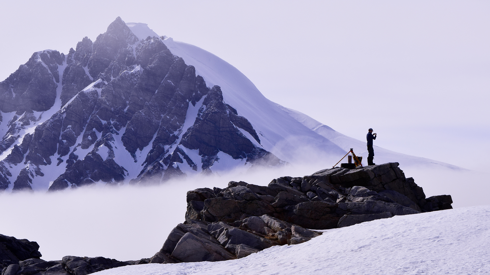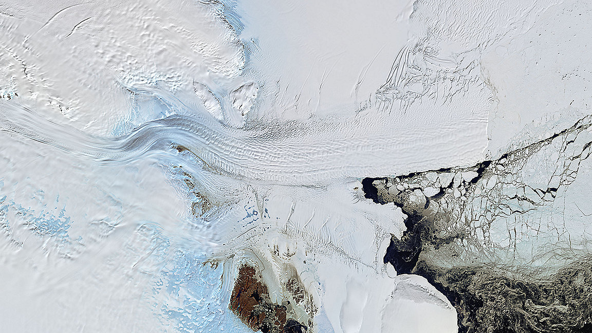
Satellite image of the Denman Glacier flowing from left to right. From about the centre of the image the glacier is now fully afloat and known as the Shackleton Ice Shelf. The ice shelf is being melted from below by the ocean and icebergs break off from its front. NASA Earth Observatory image © Joshua Stevens
Just a few decades ago, Antarctica was only crudely mapped and even less well understood. Ice was viewed as almost static, and the land beneath only thought to move on geological timescales.
But since then, the skills of surveyors – now joined by geospatial scientists – have revolutionised our understanding of how Antarctica works and how it is changing. Their work has unveiled how sensitive Antarctica is to even small changes.
Global navigation satellite system (GNSS) measurements have shown that glaciers tens of kilometres wide and hundreds of metres thick are sensitive even to the relatively small motions of the ocean tides that subtly raise and lower their front.
Exquisitely precise measurements of rock outcrops as they rebound due to glacier melt have also been used to reveal what is happening 200km beneath the ice, and how the solid Earth acts to lift glaciers and slow their retreat.
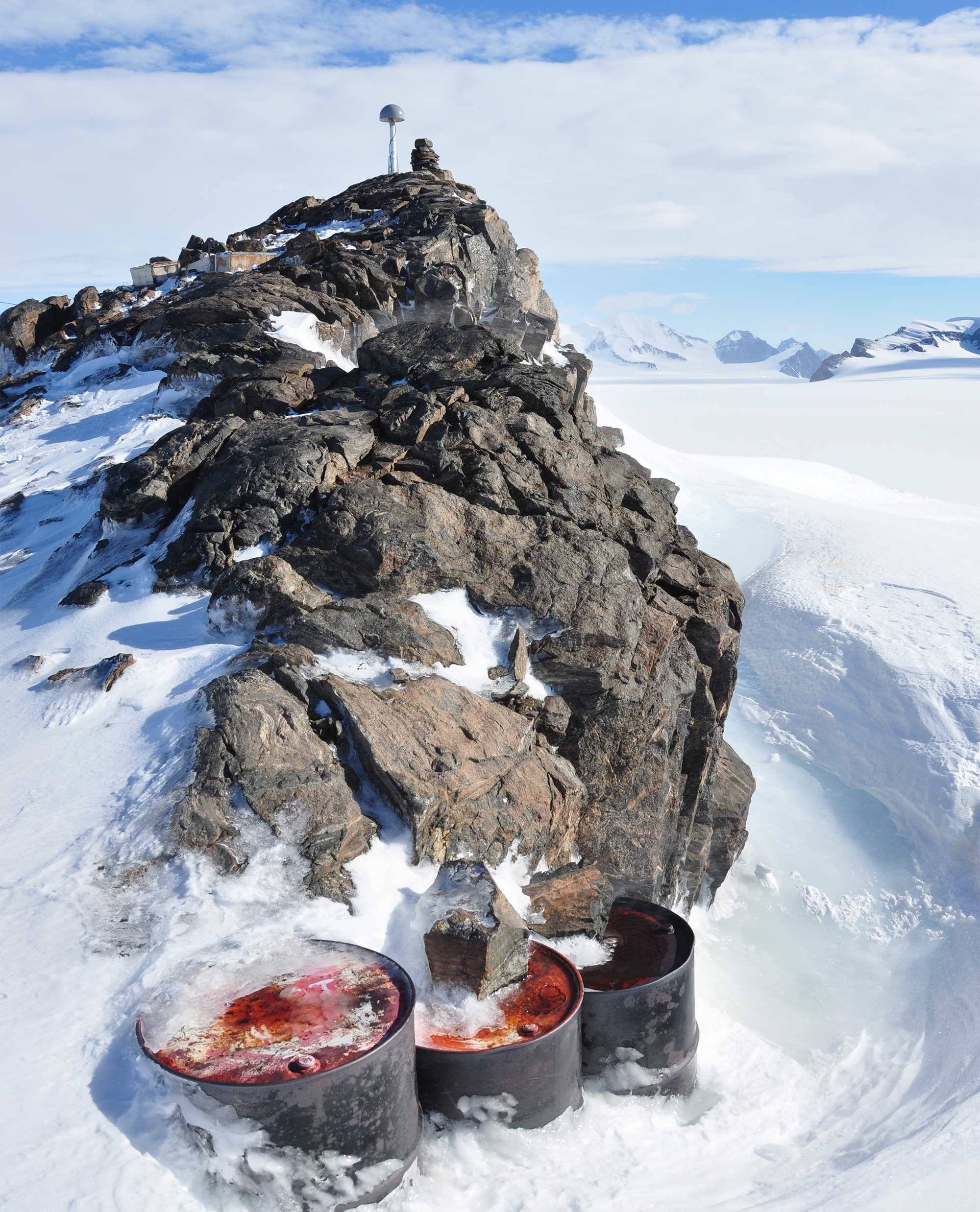
GNSS antenna and monument with aircraft fuel drums in the foreground at Jensen Nunatak in the Antarctic Peninsula. © Matt Burke
Geospatial specialists advance understanding
There are only a few centres of expertise on the use of geospatial data to understand Antarctica. The University of Tasmania (UTAS) is the most productive university in the world when it comes to Antarctic and Southern Ocean research. While UTAS research covers almost every discipline of Antarctic science, the surveying and spatial sciences team there is at the forefront of discoveries and knowledge creation.
For three decades, the surveying and geospatial sciences team has carried out research that has advanced our understanding of Antarctic processes and change in the ice sheet, sea level, terrestrial ecology, sea ice and bathymetry, among other phenomena.
Four of five permanent academic staff have been to Antarctica at least once, as have dozens of early career researchers and honours students. Many others have made use of data collected by others or via satellite sensors.
Meanwhile, graduates with skills in remote sensing, geographical information systems (GIS), and surveying have found careers applying their skills to Antarctica in industry business and government. This includes consultancy work to investigate placement of a proposed Antarctic runway or using GIS and remote sensing to manage protected areas and map environmental change.
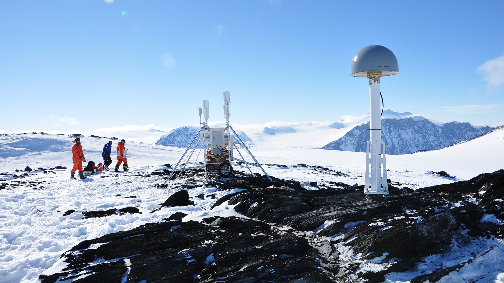
GNSS antenna and monument and vertical-axis wind and solar power system in the Hutton Mountains in the Antarctic Peninsula. The GNSS monuments connect the GPS antenna to the bedrock and allow millimetre-level motions of the bedrock to be tracked over years as it shifts in response to past and present glacier melt. The GNSS is powered entirely by renewable energy. © Matt Burke
Continent critical to global climate
This all matters because Antarctica matters to everyone on the planet: the Antarctic regulates our global climate.
The Southern Ocean is a huge sink of carbon dioxide and heat that would otherwise be in the atmosphere and accelerating climate change. Melting land ice there also drives up sea levels at coastlines around the world. Sea-level rise of more than a metre by the end of the century cannot be ruled out, with much of the uncertainty centred on Antarctica.
One prominent NGO, the International Cryosphere Climate Initiative (ICCI), has recognised that a 2°C global warming target set in the Paris Agreement of 2015 is not safe when it comes to the cryosphere and is arguing strongly that nations must agree to 1.5°C limit. Some nations are also making the point that their existence depends on it.
Remote sensing reveals extent of change
Warming beyond 1.5°C will fundamentally alter Earth's frozen regions. It is now clear that substantial change to the ice sheets and glaciers, and hence sea levels and mountain water supplies, is already guaranteed with the warming that has already happened. The situation will deteriorate with every fraction of a degree of further warming.
We are now seeing ice sheets and glaciers lose mass, floating ice shelves collapse and sea ice retreat, in ways not imagined even a few years ago. We also see which areas are not changing yet. These observations have their basis in remote sensing and satellite geodesy.
Satellite images revealed the collapse of the Conger Ice Shelf in East Antarctic in March 2022. Radar imagery is routinely used to map the acceleration of Greenland and Antarctic ice into the oceans.
Gravity measurements from the Gravity Recovery and Climate Experiment (GRACE) mission also allow scientists to remotely 'weigh' the changes in the Greenland and Antarctic ice sheets and show they are together adding about 400bn tonnes of extra water into the ocean every year.
'We are now seeing ice sheets and glaciers lose mass, floating ice shelves collapse and sea ice retreat, in ways not imagined even a few years ago'
Fieldwork supports satellite findings
But it is not just about satellite measurements: fieldwork is still critical. Over the southern summer in 2023–24, a team of 40 earth and geospatial scientists from UTAS and elsewhere have headed to the underexplored Denman Glacier region of East Antarctica.
This single glacier holds enough ice to raise sea levels globally by 1.5m if it were all to melt. Yet we know almost nothing about how thick it is; although we think part of it stretches 3,500m below sea level. This would make it the deepest land on Earth – and hugely vulnerable to ocean warming.
We know almost nothing about the bathymetry of the continental shelf to its north, either, though its shape governs the increasing possibility of warm ocean water melting it. What we do know is that it matters to everyone.
Geospatial science will be at the centre of the Denman Glacier work. The team visiting the glacier will be mapping with drones, deploying GNSS receivers to measure the motion of the bedrock around the glacier by the millimetre, and will be guided by high-resolution satellite imagery of an incredibly crevassed landscape.
This is just one glacier – there are thousands more. Many of them remain little studied, and their future is not as clear as it could be with improved mapping and monitoring.
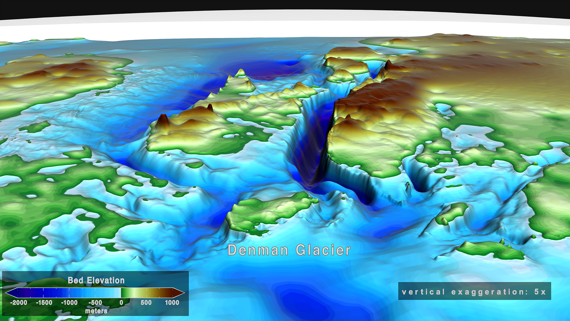
Bed topography under the Denman glacier in Antarctica coloured by elevation. Areas below sea level are in shades of blue. Areas above sea level are green, yellow and brown. This topography is hidden by kilometres of ice and its depth and shape is here largely unmeasured and instead estimated by an algorithm known as bed machine. © NASA's Scientific Visualization Studio
Surveyors' skills offer unique opportunity
Of course, working in Antarctica also represents an incredible opportunity. Surveyors and geospatial scientists often go to the furthest regions of the most remote continent, flying in helicopters and landing on rock outcrops untouched by few, or no, other humans.
George Dovers was the cartographer in Sir Douglas Mawson's 1911 Western Party, studying, exploring and mapping the region stretching hundreds of kilometres around the Denman Glacier.
He wrote to his family in February 1912: '[E]verything is just ripping[. W]e are landing in a place that will make the whole civilised world wonder … [W]hen I think of the all the fellows slaving in offices in cities when there is all this beautiful God's world to explore [and] all its wonders to see, I pity them[. T]his is living, not merely existing[.] I cannot do justice to my subject on paper, it is too wonderful.'
Everyone who has visited Antarctica will understand what Dovers was saying. To the many geospatial scientists and surveyors who feel envy reading his words, there is still a place in Antarctica for you and your skills as we help learn that which will prepare us for the future of our planet.
Matt King is professor of polar geodesy and director of the Australian Centre for Excellence in Antarctic Science, University of Tasmania
Related competencies include: Data management, GIS (geographical information systems), Remote sensing and photogrammetry
RICS and GNSS
RICS has recently updated and released its Use of Global Navigation Satellite Systems (GNSS) in land surveying and mapping, 3rd edition. This important standard is essential for all working with GNSS and its geodetic and other geospatial applications.
RICS has a long history of working with GNSS in the polar regions and some readers might find this groundbreaking RICS research from 2011 of interest.

