
Central to the UK government's plan of reducing carbon emissions to net zero is a huge increase in tree planting, and the recently launched England Woodland Creation Offer is a significant step up in efforts to achieve this by the Department for Environment, Food & Rural Affairs.
This grant replaces the Woodland Carbon Fund and is available to landowners, land managers and public bodies for support to create new woodland on areas as small as one hectare. This increased tree planting could be carried out by land managers, who would also benefit from the development of a private-sector carbon market. Income they are set to lose from the Basic Payment Scheme could then be replaced by payments from businesses seeking to offset their unavoidable carbon emissions.
But the fundamentals of this new carbon market don't yet exist. Principally, this new system needs to allow every farmer and land manager to bring forward carbon in a cost-effective way. Furthermore, to avoid accusations of greenwash, the strategy needs to measure carbon sequestration accurately enough to ensure a business's environmental, social and governance (ESG) commitments are being met and can be audited.
At the moment, the carbon market is not a true market: it's a series of awkward, brokered deals. To create a functioning market, land managers – the supply side – need to have the confidence, mechanism and incentive to increase carbon supply significantly, offering the necessary liquidity.
Digital technology, particularly the supply of earth observation data, will enable land managers to measure the number and height of trees accurately and cost-effectively, and to provide measurement data in a format that gives corporate offsetters the reassurance needed to underpin their carbon purchase.
The volume of above-ground biomass (AGB) – and therefore carbon – in the trees comes from ground truthing, using terrestrial laser scanning (TLS) from our carbon observatories, identification of broadleaf or conifer, and matching that data with the drone data from a particular forest.
Corroborating carbon claims
Businesses around the world are making bold claims of carbon neutrality through offsetting. However, with this comes increased scrutiny from customers, stakeholders and journalists. The current methodology used for supporting these claims is also under scrutiny.
Accurate data must be transparent and verifiable to ensure market confidence and stakeholder belief in nature-based solutions of carbon reduction, so businesses can use the markets without being accused of greenwashing.
Estimating a forest's above-ground carbon stocks has traditionally required measurement of trees' diameter at breast height, their overall height and the density of planting, using small plot sampling protocols. This data is then used to estimate above ground biomass volume and the biomass of entire trees, and therefore carbon stocks in a plot. The data is then extrapolated to give woodland carbon volume.
Development of models in these calibration data sets is often biased towards smaller trees, though, given that they are easier to harvest, cut and weigh. As a result, modelled carbon volumes across a whole woodland have been shown to be wildly inaccurate. Recent research using terrestrial laser scanning (TLS) shows that AGB, and therefore carbon, is currently being underestimated by up to 270% in some cases.
Tech advances increase accuracy
Encouragingly, recent advances in technology mean that the solution to these issues is within our grasp. Scientific research programmes using light detection and ranging (LiDAR) and TLS are providing a much better understanding of the volume of carbon in woodlands. This data will ensure much more accurate AGB and carbon models as a basis for marketing offsets.
Satellites are being used to monitor established forest cover, with open-source data of up to 10m resolution good for broad, risk-based assessments that identify areas of interest or potential issues. Images of the earth have been taken to this resolution for the past five or six years, and can therefore demonstrate the ability of time series data to, for instance, know when established woodland has been felled, and indicate how it has grown over time.
However, this alone does not provide the answer. The highest-resolution commercial satellites can provide data regularly, but the cost of doing so makes them unrealistic for land-use monitoring.
Furthermore, even at their 0.3m resolution, they do not show young trees before canopy closure. British weather is another issue to contend with, as satellites' ability to collect imagery is hampered by cloud cover.
Complementary approaches
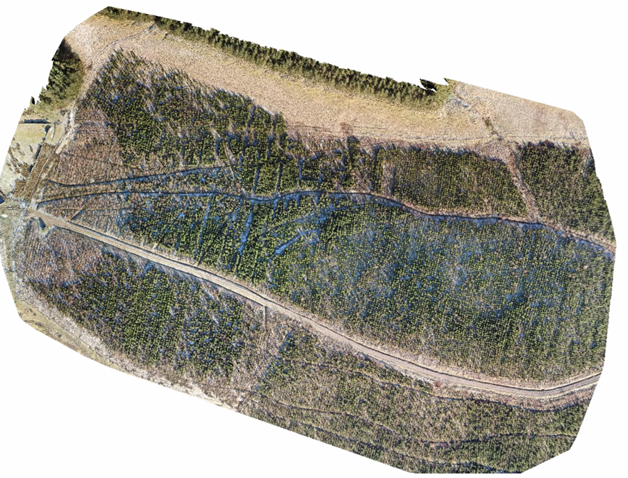
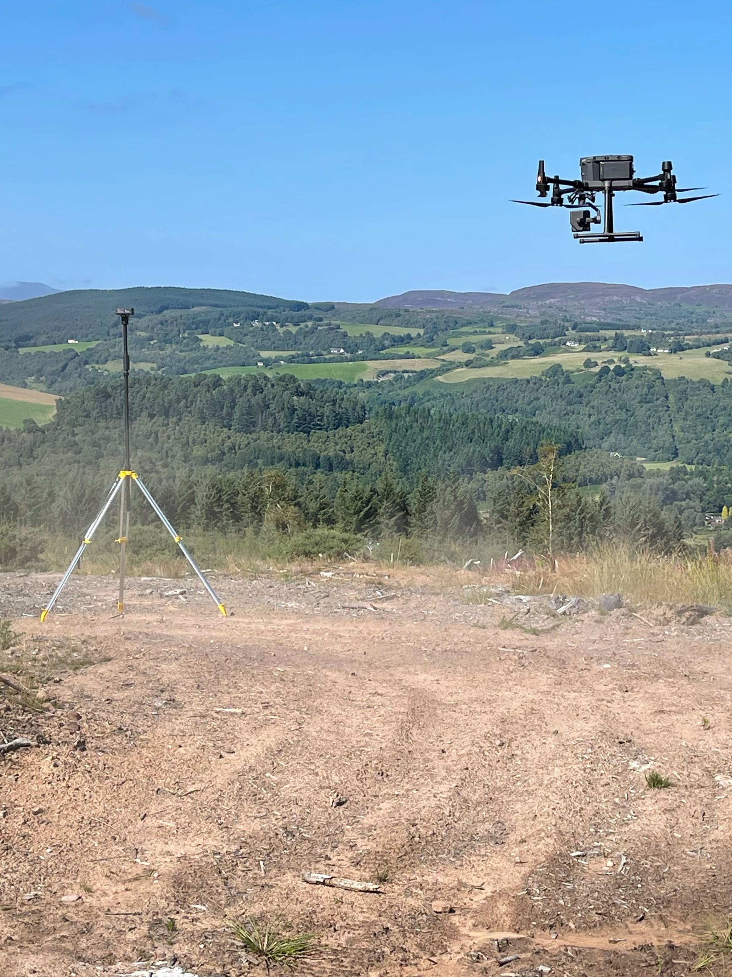
Where satellites fail, however, drones come into their own. Quality drone cameras flown at an altitude of 100m can provide images at a resolution of 5cm down to below 1.5cm, identifying trees as young as three years old. Using drones, data can be collected for a whole forest rather than having to extrapolate from a plot, thus increasing the accuracy of carbon measurement.
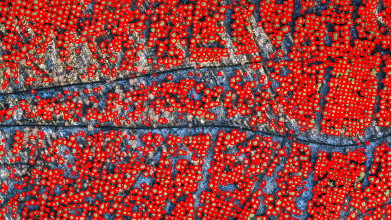
This higher-quality drone data can also enable accurate machine learning. Imagery is collected and stitched together through photogrammetry, creating a point cloud and orthomosaic or 3D representation of the planted area. Data analysts then train machines to identify trees and their sizes from the photogrammetry outputs, which can subsequently be counted and measured automatically, thus producing a more accurate AGB estimate. The image shows an orthomosaic with trees identified in this way.
This is exciting because the cost of drone technology is falling so quickly, while the capability of the equipment improves. A device with a camera of high enough quality to provide data for assessing woodlands will be affordable to most land managers, depending on their budgets, within the next 12-18 months. This means land managers will be able to measure the carbon in their woodlands more accurately than the current methodology and at a fraction of the cost.
As well as drones, smartphone software is now using computer vision and artificial intelligence so woodland managers can film forests and identify essential parameters such as individual trees, their heights, diameters, species and positions.
Testing the technology
Climate Solutions Exchange (CSX) has established carbon observatories throughout the UK that are being used as control sites to test and combine these new technologies into a robust, workable mechanism for land managers to bring their carbon to market. These sites have been chosen for their variety: bare land ready for afforestation; recently planted woodlands; and mature broadleaf, conifer and mixed woodlands.
CSX is using the observatories to gather data from a range of satellites, drones, TLS, LiDAR and ground truthing. Then it analyses their capability. Each technology has pros and cons for different scenarios. It is also collecting drone data at different resolutions, overlaps and flying heights, to establish a level of accuracy in machine learning that will be suitable for measurement needs.
The observatories are measuring the impacts of British weather on data gathered as well, to produce a quality-assured specification that land managers can follow. We are then ground-testing this data using traditional methods, and comparing these results against those obtained by TLS.
CSX is also using new commercial LiDAR scanners and comparing those results against scientific LiDAR, so that the former can be scientifically calibrated and our models adjusted as necessary. The observatories are currently testing the accuracy of data collected from smartphones against that from TLS.
We know that no single technology can provide all we need; the answer lies in the combination of multiple data sources. The skill is gathering the right data at the right price, and providing it in a way that is usable and understandable.
RICS standards and guidance
Earth observation and aerial surveys global guidance note, 6th edition is now available for members. It is intended for land, sea, engineering and environmental professionals who are acting in an advisory capacity, and by survey-knowledgeable clients who specify their own surveys. It is also intended to be used by earth observation and aerial survey specialists.
Edward Milbank is director at CSX
Contact Edward: Email
Related competencies include: Environmental assessment, Remote sensing and photogrammetry, Surveying and mapping
