In autumn 2009, I joined the Alert and Response Operations team at the World Health Organization in Geneva. My role was to help scale up innovative geomatics, or geographical information system (GIS), and information and communications technology to help analyse the global H1N1 influenza pandemic also known as swine flu.
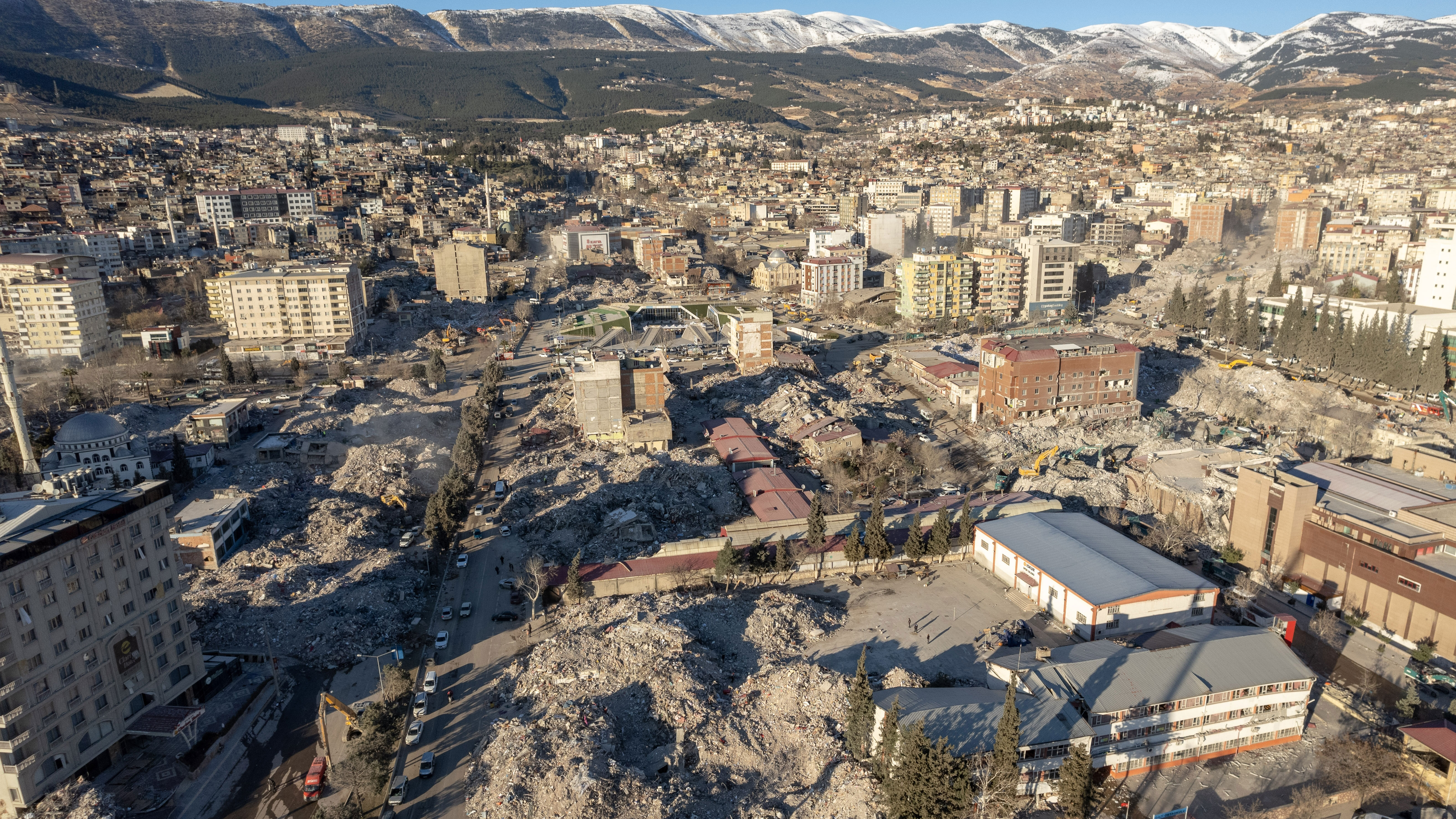
Humanitarians rarely get the luxury of time and resources to focus on only one challenge, though, and this was the case that winter. I and legions of geospatial scientists from the UN, non-governmental organisations (NGOs) and academia, also found ourselves using open-source and open-data innovations to respond to the devastating magnitude 7.0 earthquake that struck Haiti on 12 January 2010.
The challenges and opportunities presented by the new technologies were well summarised in the Harvard Humanitarian Institute's 2011 publication Disaster relief 2.0: The future of information sharing in humanitarian emergencies.
During the earthquake relief effort, the University of Hawaii's Pacific Disaster Center (PDC) provided advanced analytics to give the UN, USAID, NGOs and civilian–military responders who led the search and rescue operations the timely geospatial support they needed. This information was supplied on PDC's web-based geospatial platform EMOPS, since renamed DisasterAWARE Pro.
Subsequently in 2019, I joined PDC to help incorporate advances in earth observation or remote sensing, artificial intelligence (AI) such as AI for Humanity, and data sharing with key partners at the UN, International Federation of Red Cross and Red Crescent Societies; and the WHO's Global Outbreak Alert and Response Network during the COVID-19 pandemic.
Technology can improve early warning and response
Geospatial data coordination during rapid humanitarian response operations is now essential for the UN and NGOs given the current climate-related humanitarian crises affecting the world's most vulnerable populations. In addition, software such as PDC's multi-hazard early warning decision support platform DisasterAWARE Pro can help ensure a safer world.
All RICS members can use the free DisasterAlert app on any smartphone, laptop or tablet. PDC is also proud to co-chair the UN's Global Information Management Working Group for GIS with UNICEF, data experts at Humanitarian Open Street Map and field geospatial experts at MapAction.
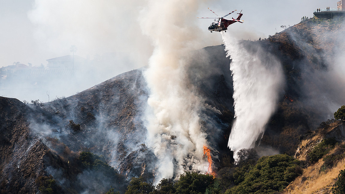
With devastating wildfires on the Hawaiian Island of Maui, Greece, and Canada last summer, unpredictable and unprecedented floods in Pakistan and the north-eastern US, PDC has been collaborating with the scientists at the NASA Earth Science and Disasters programme, led by Dr Shanna McClain, Dr Dalia Kirschbaum and Dr Maggie Glasscoe among others, to bring early warning and analytics to UN, NGOs and humanitarian partners.
Just last summer, NASA and PDC released a global landslide alerting service using earth observation and advanced analytics to save lives from Nepal to the Andes, Europe to Africa.
Towards inclusive, diverse and localised humanitarianism
McClain, Glasscoe and Kirschbaum also represent a powerful wave of women leaders at the nexus of scientific innovation and humanitarian response – a nexus that also includes PDC, whose global response and data programs are led by innovative women thought-leaders, respectively Dr. Erin Hughey and Cassie Stelow.
As the UN, NGOs, and the humanitarian and geospatial professions attempt to advance localisation beyond historically male-dominated aid systems based in the global north, PDC is proud of its diverse team of more than 50 experts. Furthermore, its global data experts have used advanced analytics to shed further light and insights on the important UN Women, Peace and Security initiatives.

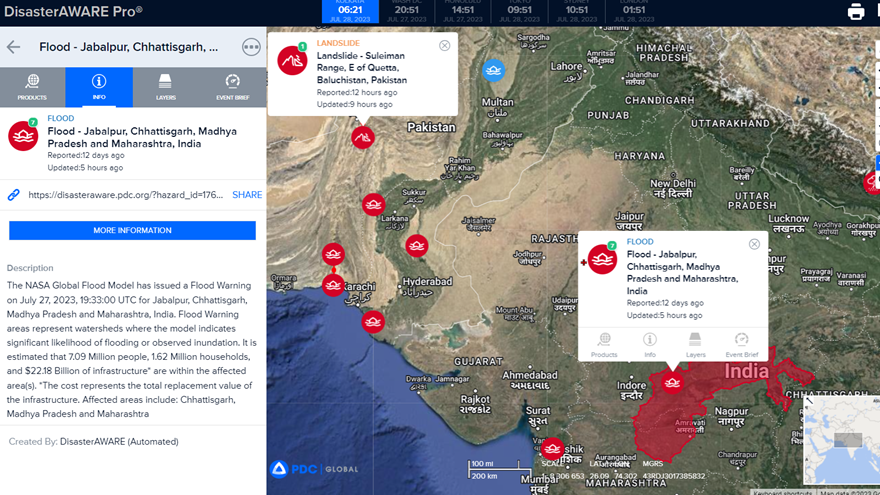
Figure 1: Screenshot of DisasterAWARE Pro showing floods in Pakistand and India, July 2023. Right click to open a new tab at full size

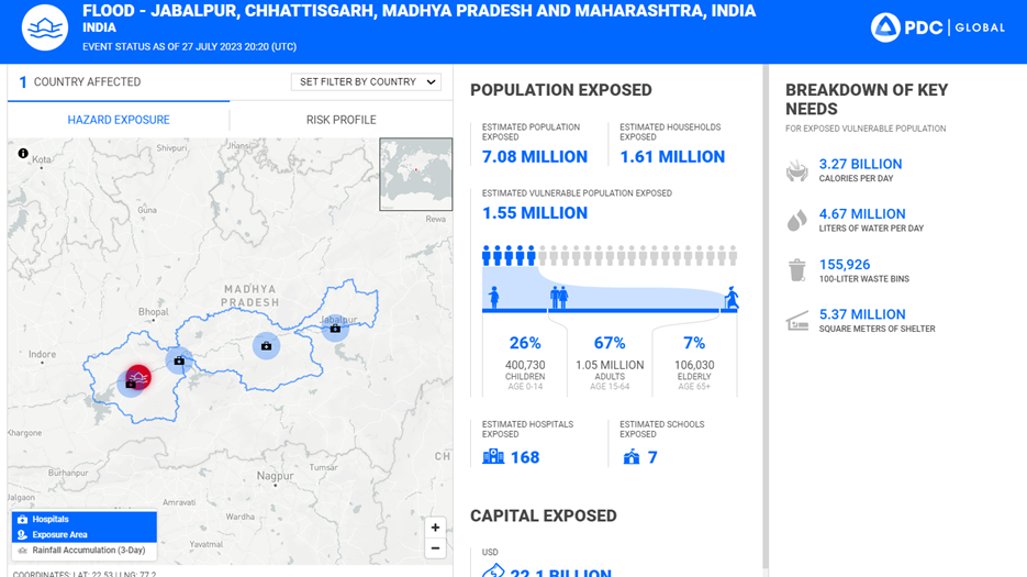
Figure 2: Screenshot showing flooding risk profile and key needs, India, July 2023. Right click to open a new tab at full size
As the UN, NGOs and the humanitarian responders move away from reactive analytics and disaster funding – which are often too little and too late in of the context of multiple crises – the real-time, cloud-based flood analytics of the types shown in Figure 2, offer two days' early warning by combining multiple global flood models into a model of models.
These high-resolution analytics use PDC's global All Hazards Impact Model, which can analyse the geospatial extent of any hazard by using population data cells of 30m resolution with advanced impact models. These are deployed through ESRI's ArcGIS Server in the Amazon Web Services cloud.
Results and insights that traditionally took human analysts hours to generate are provided in milliseconds. Lives and costs are saved and PDC helps further the UN Secretary-General's ambition to have early warnings for all by 2027.
AI enables earth observation innovation
As the world grappled with COVID-19 in spring 2020, PDC's AI and geospatial experts worked remotely to create an AI-powered hazard finder capability. They drew on hundreds of authoritative sources of information to develop an AI for Humanity.
PDC is not alone in this endeavour. Humanitarian innovation partners from Geneva to Jakarta are using AI and machine learning to increase the efficiency, accuracy and timeliness of geospatial analytics before and during humanitarian operations.
One example is the UN's Operational Satellite Program (UNOSAT). Its emergency mapping service analyses high-resolution satellite imagery for global catastrophes and uses AI for large-scale flood analytics.
Beyond the technical achievements, AI for Humanity is also seeking an inclusive and diverse pool of AI experts and leaders to ensure that algorithms and the training data behind these often black-box and opaque decisions affecting lives globally have been founded on data that's inclusive. To these ends, PDC executive director Ray Shirkhodai chaired a session of AI expert speakers at the women-led World Summit AI in Amsterdam in autumn 2022.
Furthermore, in the Asia-Pacific, Latin American and African regions, PDC has partnered with entities such as the UN Global Pulse Labs in Jakarta and Africa along with UN Women and the International Telecommunications Union to ensure a safer world.
And more recently, PDC joined a European Union collaborative project with University College London, the Technical University at Delft, and dozens of civil protection experts from Iceland, Romania, Italy, and Portugal to study high impact low probability events across the UK, Europe and globally through innovative data explorations.
Joel Myhre is senior DRR partnership specialist at the Pacific Disaster Center and co-chair of the IMWG GIS sub-group
Related competencies include: Data management, Diversity, inclusion and teamworking, GIS (geographical information systems), Remote sensing and photogrammetry

