Voluntary organisations such as Mountain Rescue carry out much search and rescue work in the UK. But as they are staffed by volunteers and receive little or no government money, their budgets are often tight and determined by how much fundraising a team can carry out.
Developing programmes to support new technologies and operating procedures takes time as well, relying on team members taking on additional duties over and above their volunteering commitments.
Technological advances put aerial equipment in reach
Until recently, the drone technology available to such organisations was primarily consumer level. Devices were limited by the quality of the sensors and a lack of poor-weather capability.
However, recent advances in the technology and the ever-decreasing price of equipment now means that all-weather aircraft with high-resolution thermal sensors and high-powered zoom cameras are potentially within the reach of volunteer teams.
This is nevertheless a significant expenditure, and when an organisation commits to setting up a drone team it needs to consider training time and costs, insurance and ongoing maintenance. All voluntary search and rescue teams operating in the UK have to comply with Civil Aviation Authority (CAA) regulations governing the use of drones: there are no exemptions.
Most Mountain Rescue England & Wales (MREW) teams who operate drones have therefore elected to train their pilots to complete the general visual line of sight certificate level. They then obtain an operational authorisation from the CAA and are afforded some privileges not available to recreational pilots, primarily in the separation from uninvolved persons.
Uninvolved persons are usually required to be 50m (horizontal) distance away from operations. With this comes extra responsibility in terms of pilot training, currency, risk assessments, equipment maintenance and being subject to CAA audits.
Drones help to automate mapping
When a pilot is required to search an area, a drone deployment is assessed according to the particular circumstances. The time of day, environmental conditions, terrain to be searched and the presence of the public all need to be considered. A risk assessment is carried out as part of CAA compliance and documented for each flight before taking off. Other air users also need to be notified of the operation.
One avenue that MREW teams are taking is combining manual operations and autonomous flight paths. Many surveyors will be familiar with this approach, having used drones flying autonomous grid patterns to generate mapping data. This has been further developed in house by MREW, based on detailed elevation data provided by Ordnance Survey.
Some years ago MREW volunteers developed MRMap, a tool that is used to display detailed maps of a given search area either on site or back at base. These are then split into manageable sections for teams working on foot, who may be accompanied by dogs. The latest iteration of the tool allows a search area to be allocated to a drone.
A detailed flight path is then determined at a user-defined height, which closely follows even complex terrain. Multiple high-resolution images are taken with the camera angle being adjusted from one point to the next to remain perpendicular to the underlying terrain. The overlap between images ensures each point in the search area is photographed between six and nine times.
After the drone returns, the images are loaded on to a laptop and analysed, on site, for colour-based anomalies. A missing person, or their kit, will be a different colour to the surrounding environment and the software will pick this up as an area to be physically searched.
As the software indicates exactly where each image was taken, the height, shape of the terrain, camera angle and image resolution, it can determine the exact size and position – to within 1m – of each anomaly. Each item of interest is relayed to the operator for further investigation. Using this approach, a 500m-by-500m square grid can be searched in around 15 to 20 minutes.
'One avenue that MREW teams are taking is combining manual operations and autonomous flight paths'

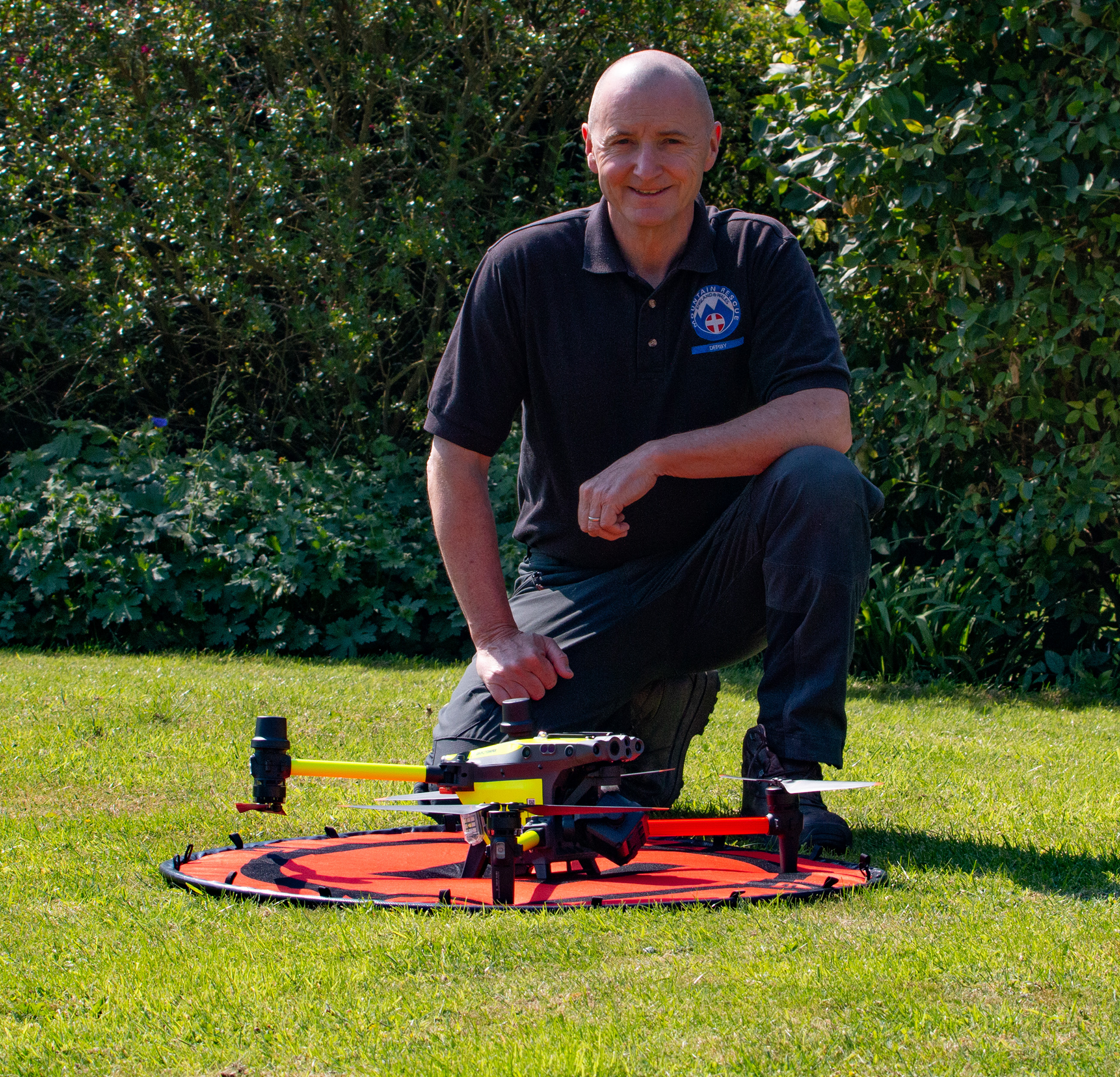
Brendan O'Neill prepares the DJI M30T drone for take-off at the training site on the edge of the Peak District. Image © Brendan O'Neill
Recoveries demonstrate value of integrated approach
This MRMap approach was deployed successfully in Glencoe, Scotland late last year. A walker had been reported missing, and a large multi-agency search had been carried out over ten days. A few days in, the walker's backpack was found but there was no other sign of him.
A number of weeks after this initial search, a team from the Lake District Mountain Rescue Association were deployed to the area. After consulting with the local teams involved in the original operation, they put together a comprehensive drone search plan of 20 areas.
The terrain was unforgiving and consisted of steep, exposed mountain sides and crags. Following the first flight, the software identified an anomaly. It wasn't apparent from the image what this was so a second drone was deployed to the exact coordinates indicated. Sadly it turned out to be the body of the missing walker. Ground teams were directed to recover his remains, helping bring closure for the man's family.

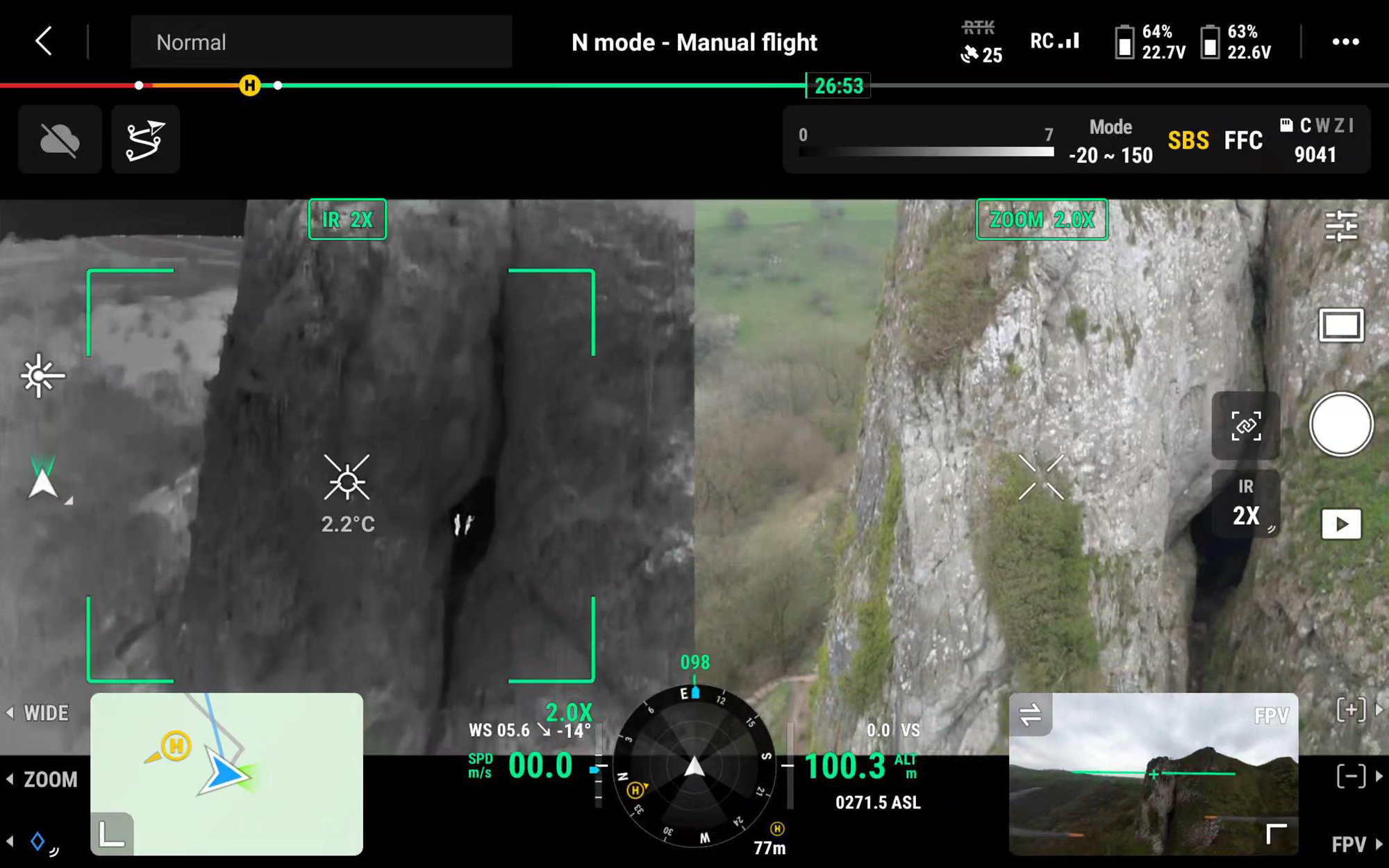
Right click to open image in new tab. Screengrab of video footage from Figgy's rescue using DJI M30T drone. The left hand side shows the thermal image with two of the rescue team in the cave. The right hand side shows the daylight camera view. Image © Brendan O'Neill
Another recent search involved a manually controlled flight searching for a missing dog. Figgy the spaniel had run off the edge of a 120m-high cliff in the Peak District. Her owner called the emergency services after injuring herself trying to find the dog. Derby Mountain Rescue team spent a number of hours using rope systems to search the near-vertical cliff face.
The drone was then requested and ten minutes into the flight, a thermal signature was detected just outside the search area. The daylight zoom camera didn't initially show anything so the aircraft was repositioned to get a better view.
Figgy was found with minimal injuries, wedged behind a tree having fallen more than 60m. The rope system was redeployed and a team member was sent down to recover her. Being a bit excited, the dog was secured inside a large rucksack to be taken back to ground level for an emotional reunion with her owner.
As the technology and software develops, it is likely that the crossover between geospatial surveying and search and rescue requirements can be further leveraged to help search for missing people.
Contact Brendan to find out more about Mountain Rescue England & Wales and the work of your local teams.
Brendan O'Neill is national drone officer for MREW and operational drone lead for Derby Mountain Rescue Team in the Peak District and surrounding areas
Related competencies include: GIS (geographical information systems), Remote sensing and photogrammetry, Surveying and mapping
RICS standard supports UAV use
The current edition of RICS' Earth observation and aerial surveys professional standard covers drone operation and the collection of imagery, to help operators in the UK ensure they comply with the Civil Aviation Authority (CAA) regulations on UAV use. Whether professionals or volunteers, all drone operators must also fulfil the mandatory requirements set out in the CAA regulations.

