Wellington College, Berkshire © Wellington College
Since completing my master's degree in geospatial and mapping sciences at the University of Glasgow about five years ago, I have been working as a land surveyor at Glanville Consultants on projects in a wide variety of locations, each with its unique challenges and rewards.
What my days have in common is a mixture of working on site to collect data and producing and processing plans in the office using computer-aided design (CAD). My role also involves communication with clients and other professionals involved on projects.
Preparing for access, safety and accuracy
Before travelling to a site, I review the job to give me an idea of what is required. Checking the survey extents immediately before the site visit is particularly important because these may change at the last minute. The accuracy and purpose of the survey will also determine what equipment is required; for instance, not all measured building surveys will require a laser scanner, depending on the level of detail that is necessary.
As a geomatics surveyor, I need to work in the most efficient and timely way, without compromising on accuracy. Good planning is therefore needed to mitigate any access restrictions unique to a site, as some areas may only be available at certain times of the day, for example, when occupiers are not present.
Before I leave the office, I ensure access has been arranged and check any other arrangements so I can enter the site safely. I prepare for a variety of conditions and health and safety hazards, and pack the necessary kit.
Often I meet the client or landowner so they can provide access and discuss any further requirements. This gives them the chance to highlight areas of importance, and is my first opportunity to build a positive relationship with them. Some sites, particularly those under construction, may require an induction to ensure you are familiar with any specific hazards and control measures that are in place.
Once access has been granted, I recce the site or building so I understand the extents and any safety concerns. When I start work, my responsibility is to collect sufficient data for the purpose of the survey and the accuracy specified.
Variety of site work and surveys
Each type of survey has its own challenges, which keeps my job interesting. Typical surveys I carry out are:
- topographic
- measured building
- river
- setting out
- heritage.
I have carried out topographic surveys in a range of locations, from a stretch of the A1 at night to the lovely grounds of Wellington College. Likewise, I have carried out measured building surveys in various places from abandoned buildings to manor houses, often working on roofs.
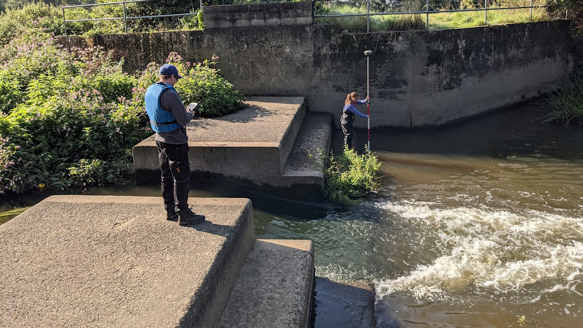
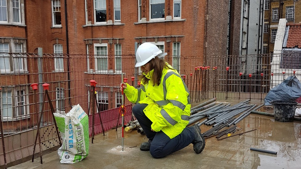
Setting out offers the opportunity to get involved in high-precision work on construction sites. I have also had some experience completing river surveys on the River Thames and River Mole, which present their own challenges due to the environment. Rivers are dynamic, which poses health and safety risks that we must monitor constantly – all while focusing on the survey.
One of my favourite aspects of surveying is to work on heritage projects, and I have been lucky enough to work at Kensington Palace and Hampton Court Palace alike. My most recent project involved mapping the stonework inside the King's Stairs and Clock Court at Hampton Court. This is a wonderful location where you are surrounded by history. We used a combination of laser scanning and photogrammetry to produce detailed vector plans of the paving stones, cobbles and surface condition, the plans of which were used to help the required restoration and repairs.
I select instruments according to the detail and accuracy required. Surveyors commonly use total stations to measure angles and distances; however, new technologies are improving the way we collect data. Laser scanners are increasingly a core part of our job, allowing us to carry out more efficient and accurate surveys. No matter what technology is used, it is crucial to establish a good control network. This is the basis for the survey, and allows me to check any errors as well as ensuring that the correct tolerances for the survey as stated in the specification are met. For example, using Trimble total stations I can view any errors between each control station while on site and minimise errors further down the line.
Aside from technical challenges, I often face other complications when carrying out a survey. Working on confidential and contentious sites can require discretion, especially if local residents don't support the development.

Lauren Whittaker completing a river survey on the River Mole

Lauren Whittaker setting out, Mayfair, London
Turning site data into final plans
When I return to the office it is my responsibility to export and process the data that I collected on site.
Processing the total station data allows the angles and distances observed to be computed so I can derive the coordinates of the surveyed points. Processing laser scan data is a bit more involved, and requires matching the scans together to produce a unified point cloud.
All data processing requires an understanding of geomatics and a familiarity with the specification for each project. This part of the job in particular requires problem-solving skills, to ensure that the observations are within the desired accuracy. If there are any errors that exceed the tolerance we investigate and resolve them. So it can be tough, but it's enjoyable to see the data come together.
Survey drawings or plans are the main output from most surveys. I draw the plans in CAD for a topographic survey, elevations or floor plans. These may be drawn either from surveyed points taken from the total station or from a point cloud.
Using a level of detail appropriate to the requirements is an important skill for a surveyor as any details missed may be disastrous for a construction project.
Before the final drawings are sent to the client, I ensure that one of my colleagues checks them. This is part of our quality assurance procedures because designers rely on the plans for future developments. The task includes checking the completeness of the survey, its accuracy and presentation, and spelling.
Why choose a career in land surveying?
- Rewarding and satisfying: surveyors are involved in all stages from the initial survey and site work to drawing and delivering the final plans to clients. No matter how big or small the survey, there are always challenges; and once our work is completed it's rewarding to know the survey plays a crucial part.
- Variety: I am fortunate enough to work on a range of surveys, each with its distinctive characteristics. Land surveying also means working in a variety of locations from the obscure to the prestigious, which makes it an enjoyable career.
- Applying my skills and degree: I love using the skills learnt from my master's in surveying in my daily job. The challenges and variety presented by land surveying means that I am always learning. My next goal is to achieve MRICS status on the geomatics pathway.
Lauren Whittaker is senior land surveyor at Glanville Consultants
Related competencies include: Data management, Measurement, Remote sensing and photogrammetry, Surveying and mapping
Geospatial careers
RICS has collaborated with our geospatial sector colleagues on a number of career-related initiatives, such as Geospatial UK and Get Kids into Survey (as featured in the RICS Land Journal). Careers will also feature at this year's GeoBusiness show (17–18 May).

