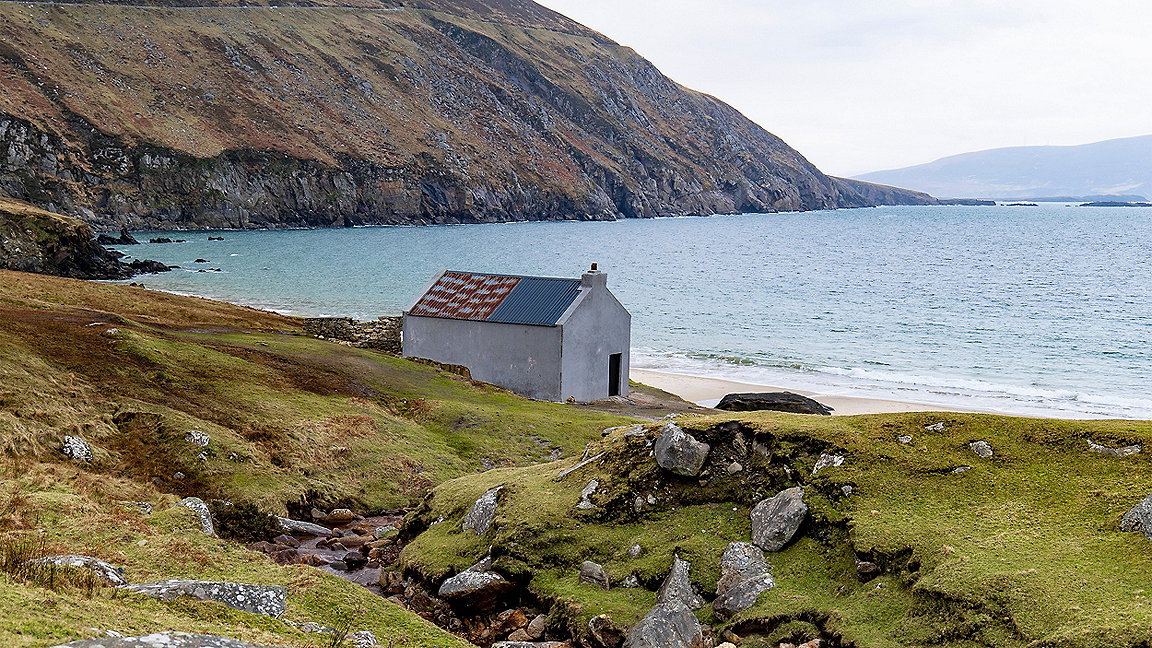
View of Keem beach over Colm's house
When Ardmore Studios asked our geospatial firm to support the production of the recent Martin McDonagh film The Banshees of Inisherin, we worked closely with the filmmakers on five sets across the islands of Achill and Inishmore off the west coast of Ireland.
The film crew were extremely helpful, allowing us the time to capture sites digitally between shoots on the two sets on Achill and three on Inishmore. This involved laser scanning using high-definition surveying (HDS) laser scanners, and photogrammetry with digital single-lens reflex cameras (DSLRs).
Geospatial surveyors play key background role
Geospatial has an important part to play in digital production and visual effects (VFX) processes because geospatial surveyors can accurately capture, or record, a physical set and process it into a 3D textured mesh for the VFX teams to work on.
The mesh itself is developed from point-cloud data collected using the 3D laser scanners. Each mesh consists of millions of polygons – most of them triangles – connected to vertices in the point cloud. These are then textured using 2D images projected onto them.
The resulting textured meshes provide a geometrically accurate representation of the set to inform, and lend realism to, any computer-generated imagery (CGI).
Collecting detailed scans on set
Our surveyors had to be as unobtrusive as possible when collecting data, working around the set dressing and being careful not to disturb any props or scenery. Anyone who has seen the film will recognise the sets, namely J.J. Devine's pub, Colm's house and the Súilleabháin house.
In total, our survey team spent four days on set. Thankfully, we were lucky with the weather and got a run of dry days. Rain would have affected the quality of the raw data because the scanner would have picked it up and created unwanted noise in the resultant scans.
We used the Leica RTC360 3D laser scanner for this job. HDS scanning of this type generates an extremely dense point cloud. The high-resolution scans can then be pre-registered – that is, stitched together – in the field, which saves processing time back in the office.
Importantly for this project, the RTC360 also collects high-dynamic range (HDR) imagery in 5K resolution, amounting to 14.7 million pixels. This resolution means the imagery is better able to highlight contrasting conditions, such as inside the houses.
Most scans were made to a resolution of 3mm @ 10m, which is at a high density setting with a scan time of two minutes and 40 seconds. However, if we were closer to the target object, we used a resolution of 6mm @ 10m, which is a medium density setting with a scan time of one minute 50 seconds. We needed around 50 scans per set this meant that the total scanning time on all five was around 11 hours.
The surveyors needed to be highly accurate to ensure full coverage of all details in the set; for instance, we used an extendable tripod to make a comprehensive record of the roof. Others required mini tripods to collect detail, under tables in the bar for instance.
We also captured each set for photogrammetry using a Canon EOS R5 45 MP DSLR. These images were used to supplement the texturing of the mesh, filling any gaps in the laser scan data to improve the overall quality.
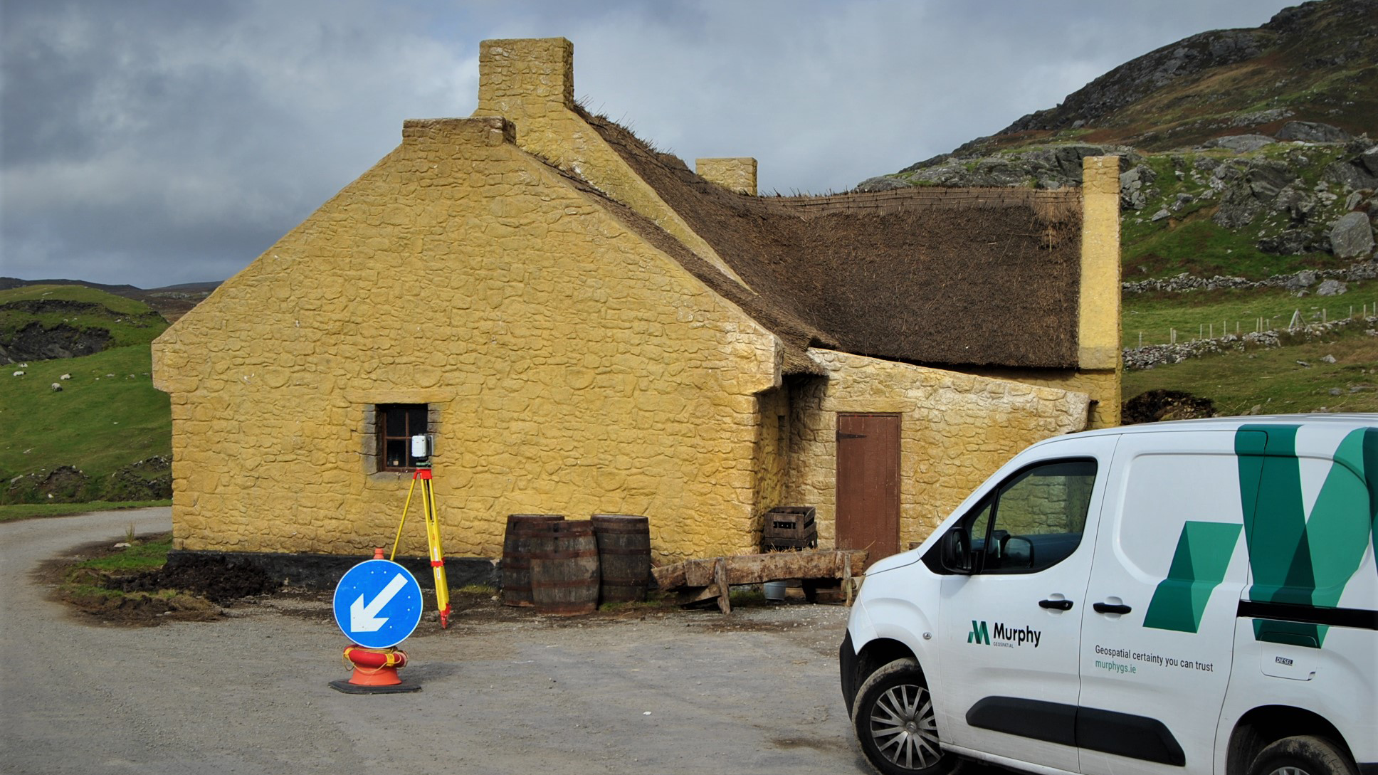
Scanning outside J.J. Devine's pub © Murphy Geospatial
Checking, cleaning and processing the point cloud
The raw scans of the sets were pre-registered on set. However, we also carried out a full check and quality assurance (QA) in the office using Leica Cyclone Register 360.
This highly effective software processes the scan data, and is used for the final stage of the point-cloud processing. It enables QA of all constraints, such as checking the links of each scan, before exporting the data for the mesh.
Each raw scan was cleaned manually, which was an extensive job; the glasses on the bar in the pub were a particular challenge. After the point cloud was deemed clean enough and had passed QA it was exported from Cyclone to e57 format, which is used for the exchange of 3D imaging data, before importing it into Capturing Reality software.
In Capturing Reality, we used the coloured, structured e57s to construct the mesh, which had already been geocordinated using the registration from Cyclone. We then removed any large marginal triangles from the mesh, before simplifying, unwrapping and texturing it.
The quality of the data from the site enabled the process to be streamlined and left no holes to be filled.
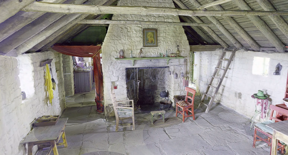
Mesh of interior of Pádraic and Siobhán's house © Murphy Geospatial
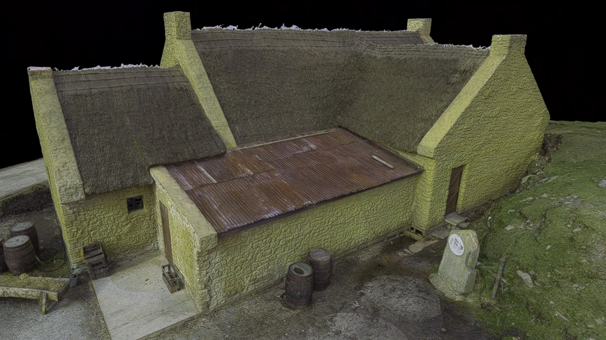
Mesh view outside J.J. Devine's pub © Murphy Geospatial
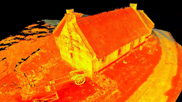
Intensity point cloud of J.J. Devine's pub © Murphy Geospatial
Overcoming challenges and striking a balance
Our team motto – 'Good data in, good data out' – was particularly relevant to the meshing for this project.
The challenge we faced outdoors was ensuring that we were able to capture good data despite the west of Ireland's weather and an active film crew. The biggest challenge on internal sets, meanwhile, was light.
To deal with the latter our surveyors carefully placed supplementary lighting around the set, ensuring it was not captured in the scans or imagery but prevented shadowing or unclear images as far as possible, which could lead to unwanted variations during processing. The supplementary lighting was effective and considerably reduced shadowing.
We also needed to agree with the VFX team the right balance between mesh size and quality. As the size of a mesh increases, it can become slow to load and difficult to work with. Simplifying to 40 million triangles to provide a 5GB mesh struck the right balance.
From initial set visit to issuing the final mesh took between three and four weeks. Our team is proud to have contributed to an Oscar-nominated film, and delighted to have supported the VFX team in developing their CGI using accurate geospatial data.
Our experiences taught us that laser scanning on film sets requires patience, an eye for detail, respect for the production team and the ability to be flexible. As geospatial surveyors, we gained a huge appreciation for the skills of the filmmakers in creating a reality in a different time and place.
Robert Bartley AssocRICS is head of digital engineering (Ireland), Murphy Geospatial
Contact Robert: Email
Related competencies include: GIS (geographical information systems), Remote sensing and photogrammetry, Surveying and mapping
RICS guidance supports geospatial practice
RICS has published a range of geospatial surveying guidance to support the collection and presentation of geospatial data in a timely, costed and accurate manner that meets client requirements.
A new edition of Guidelines for the use of GNSS in land surveying and mapping is due to be published this summer, for instance, while other RICS guidance relevant for geospatial professionals includes Earth observation and aerial surveys and Measured surveys of land, buildings and utilities.

