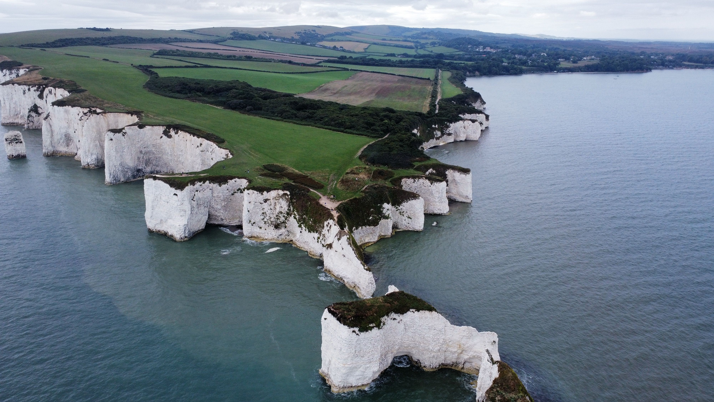
Glen Lee. © Cairngorms National Park Authority/Alaska Stikova
A collaborative approach to understanding natural capital and its impact on decision-making may sound overly complex, given that it has to combine all available information and various opinions. However, such collaboration is necessary to avoid unintended consequences.
For instance, peatland has historically been seen as wasteland, and over the centuries various attempts have been made to make it productive, from draining, cutting, burning and afforestation to rough grazing. Yet even once the environmental impact of this was understood hill draining continued until the 1970s, while peat is still being sold for gardening.
While trees are often promoted as a solution for carbon absorption and biodiversity enhancement, the reality can be more complex. The positive or negative effect of tree planting depends significantly on the type of trees, their location, rate of growth and, in particular, the existing organic matter in the soil.
The strong demand for peatland restoration and afforestation aims to promote carbon sequestration. However, done in the wrong way in the wrong place, the result can be increased carbon emissions. If we are to achieve positive outcomes experts, landowners and stakeholders need to collaborate to ensure a sustainable increase in carbon storage and biodiversity, avoiding unintended consequences.
Consortium engaged to consult on landscape improvement
In 2022, landowners in the South Deeside–North Angus deer management group (DMG) and the Cairngorms National Park Authority wanted to better understand the natural capital for which they are responsible, in the light of Heritage Horizons: Cairngorms 2030.
This programme aims to mitigate climate change, enhance nature and support people's health and well-being. To improve their understanding, therefore, they collaborated with a consortium of consultancies led by Caorann to carry out a landscape-scale analysis.
Improving natural capital by restoring peatland and habitats and increasing biodiversity in a relatively harsh natural environment can be challenging. This is aggravated by conflicting government policies and regulations about land-use changes, as well as controversies between policymakers, the public and the private sector.
However, by applying modern geospatial sciences, the Caorann-led consortium – comprising EOLAS Insight, Landfor, Caledonian Climate and Omanos Analytics – identified significant opportunities for improvement by taking a holistic, data-driven approach. This combined practical ecological expertise, technology, geospatial science, knowledge of natural capital asset management and carbon finance. The method involves fully understanding the local area before recommending how best to invest in natural capital across the whole landscape.
The consortium used the most up-to-date open datasets, artificial intelligence (AI) modelling and geographic information systems (GIS) technologies to enhance spatial analysis and remote sensing capabilities, while ensuring interdisciplinary collaboration at all stages.
Technology offers insights to inform decision-making
The above approach offers benefits over traditional methods, which typically involve early definition of labour-intensive field surveys. These can be time-consuming if the potential restoration is not first considered in its context.
In contrast, modern geospatial sciences allow for real-time data collection and analysis to provide more comprehensive insights, especially at landscape scale. The integration of AI, predictive modelling and advanced GIS technologies, together with on-the-ground efforts and clear communication with local communities, enhances decision-making, leading to more effective and efficient management of natural resources.
The consortium assessed more than 65,000ha – or 14% of the national park's area – to give the DMG and the park authority a better understanding of existing natural capital and opportunities to enhance it, as well as some of the risks in doing so.
The project aimed to consolidate the efforts of proactive landowners by giving them all the available information before they made any major decisions, such as which areas to prioritise for restoration works. By visualising conditions, options and risks during the scoping phase, the consortium increased collaboration across estate boundaries by attempting to optimise the balance of financial benefits and mitigating risks inherent in various land uses.
A key component of this approach was gaining a thorough understanding of the area, breaking down natural capital into fundamental considerations and investigating relevant metrics and conditions.
Natural capital broken down into key considerations
Critical considerations for the consortium included the following.
- Wildlife management: deer are crucial to Scotland's ecological balance, with their management serving as a cornerstone for numerous, broader land management goals. Effective deer management offers multiple benefits, including preserving environmental health, bolstering the economic stability of rural areas, promoting human well-being, and ensuring the welfare of the animals themselves. Moreover, venison offers a natural, sustainably reared and nutritious food source. In the five years to 2022, the DMG had reduced deer numbers from 13.7 to 9.7 deer per square kilometre, decreasing grazing pressures, damage to young trees and crops and soil erosion among other things. This supports ecological balance, sustainable land management and the overall health of the environment, as well as the community's well-being.
- Peatland restoration: detailed analysis of peatland conditions across South Deeside–North Angus identified 8,829ha of eroded and/or drained peat. If this area were restored, it could reduce emissions by 20,000–30,000 tonnes of carbon dioxide equivalent a year.
- Woodland creation: in line with the goal of reaching 21% woodland cover across Scotland by 2032, restoration and creation projects in the South Deeside–North Angus area aim to raise their contribution. These initiatives promise benefits such as carbon sequestration, timber production, recreation, biodiversity enhancement, improved water quality and flood risk mitigation.
- Habitat creation and biodiversity improvement: enhancing ecological habitat networks, especially for fragmented native woodlands, offers numerous benefits. For instance, increasing riparian woodlands can significantly promote biodiversity, supporting threatened species such as Atlantic salmon by providing shaded, cooler watercourses, more stable riverbanks, and greater protection for juvenile fish from predators in the form of fallen trees left in the water.
Cross-boundary collaboration enables more consistent data
The initial stage of the project involved sourcing geospatial data and engaging closely with estates. It quickly revealed significant variations in the data available, influenced by multiple factors such as changes to funding regimes and reporting requirements over time.
This therefore emphasised the necessity for cross-boundary collaboration, which is particularly valuable for understanding wildlife movement. It is beneficial, for instance, to use tools such as the blanket bog user guide consistently to monitor what effects animals have on a landscape.
Historic and current herbivore impacts affect blanket bog, structure and species composition. For example, gamekeepers or ecologists observe trampling, browsing or grazing effects on ground cover and plant indicators, gauging impact levels from 'no impact' to 'very high'. These results help predict future changes in blanket bogs and inform management decisions to meet natural capital objectives.
As the method had not been standardised in the South Deeside–North Angus area yet, the consortium realised a national-level dataset would be preferable to a localised option. By merging such larger-scale datasets it produced a more robust geospatial model, drawing attention to intricate interactions such as those between deer populations and restoration efforts.
All outputs for the project served two purposes. First, they enabled the quantification of existing stock along with recording landscape conditions; and second, they allowed the consortium to create opportunity maps that identify areas suitable for restoration and regeneration, emphasising the potential to increase riparian woodland, healthy peatlands and higher biodiversity.
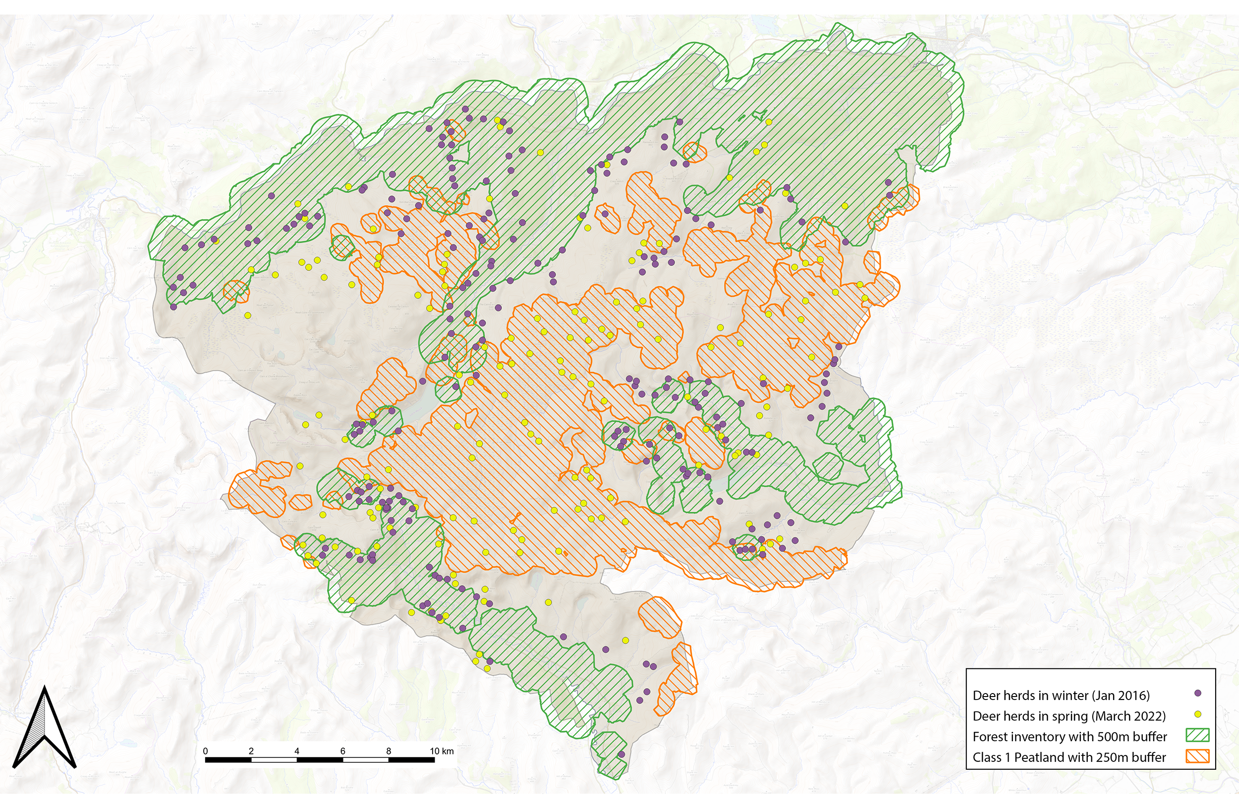
As well as taking herbivore impact into account for restoration works, research shows that deer and other herbivores do not graze evenly across landscapes. Their distribution is influenced by shelter, access to water, the quality of vegetation, human activity, livestock grazing, and habitat exclusions. Deer count data reveals that deer gather in lowland areas with shelter during winter and in upland areas, especially peatland, during spring and summer, as seen in figure 1.
Subsequent analysis entailed inputs about land use, soil type, carbon content, herbivore management and water quality. Merging diverse open datasets from government, research institutions and academic sources offered a holistic perspective on natural processes for the region. The amalgamation of these with insights from ecological and environmental science allowed the computation of core metrics, such as quantifications of woodland stock, carbon storage potential and deer numbers.
'The consortium produced a more robust geospatial model, drawing attention to intricate interactions such as those between deer populations and restoration efforts'

Figure 1: Comparison of winter and summer deer behaviours in South Deeside–North Angus and their impact on potential types of restoration work. Sources: NatureScot and Scottish Forestry
Context critical to reconcile scales
However, metrics and mapping both rely on context. A cohort of land managers added invaluable input and guidance that dealt with on-the-ground issues, exposing several areas where policy is unclear, data is incomplete and information is not available to support effective decision-making.
Notably, the gap between national datasets and ground surveys – particularly in data about soil types – was a challenge. While valuable at a national scale, existing soil research lacks the granularity essential for estate-level decisions. Once a site has been chosen for a new natural asset, therefore, a more precise ground survey can be carried out. Further funding to refine national-level data, supported by clear policy directives, could be pivotal in advancing landscape-scale nature-based solutions.
The commercial side of restoration work was also considered. Certain sites posed financial and contract challenges when indicative woodland and peatland project costs were compared with current carbon credit values. These challenges included the cost of site access, the requirement for interventions such as fencing and the monitoring requirements for restoration works and the long-term nature of current carbon credit contracts.
While potential financial justification may improve as carbon markets mature, additional support is currently imperative. While the emergence of carbon credit schemes that offer green finance is welcome, more immediate innovations may be required to improve and protect our natural assets. Effective management of natural assets, such as riparian woodlands, is critical not only for maximising financial viability of restoration projects but also for the wider ecological health.
Communication and compromise enable effective outcomes
Blending metrics and maps with on-the-ground context is pivotal in enabling geospatial information to have a practical impact.
While several tools in development such as the NatureScot landscape-scale natural capital tool may help planning for such projects, these are based on datasets that do not always best represent ground conditions. Understanding such limitations and clearly communicating them to decision-makers is fundamental to the success of projects.
Through the South Deeside–North Angus working group meetings, which included experts on restoration types, land management and mapping data, the consortium could assess issues holistically and reach more balanced conclusions.
The main lesson learned was that, for any landscape-scale natural capital project, the most important requirement is a functional team that can understand the variety of challenges faced by other groups and is open to collaboration.
In this way, decision-makers can be supported to make the most effective choices about the land they manage. The South Deeside–North Angus DMG landscape-scale natural capital report will be published later this year, featuring more specific recommendations for the area.
Making good decisions depends on having all the available information, representing many viewpoints and considering our landscape holistically. The results of the actions taken subsequently will not be felt for hundreds of years: but working together offers the best chance of ensuring a positive, long-term outcome.
Douglas McNeil is managing director at EOLAS Insight
Related competencies include: Data management, GIS (geographical information systems)

