Q: Tell me about the Ramblers' project Don’t Lose Your Way.
Jack Cornish: Before the middle of the last century, people in England and Wales knew where they could walk or ride a horse in their local area. Then in the 1950s and 60s, local authorities started recording rights of way on a legal record. So they consulted and then drew up maps. But that was not a completely successful exercise and some paths were missed. In successive decades people contacted local authorities to let them know certain paths were missing.
Then, as part of the Countryside and Rights of Way Act 2000, it was agreed that there would be a deadline by which people should let local authorities know whether something was missing from the map. That was a compromise – but the flip side is that we got open-access land, which provided a right to roam in a good chunk of England and Wales.
But landowners wanted some certainty about what rights of way were on their land, so a cut-off date was set, 1 January 2026. The government promised funding and said it would make sure these paths were found and restored to the record.
When it became clear that this wasn't going to happen, in about 2015, the Ramblers stepped up encouraging volunteers, members and anyone who wants to get involved to claim these paths and put them back on the map.
Q: Was the reason the 2000 Act didn't work because the funding did not come through for a full survey?
JC: A lot of money was spent on a pilot project in the mid-2000s called Discovering Lost Ways, but this didn't actually achieve a great deal. However, it did at least determine that the problem of potential lost rights of way is significant in size.
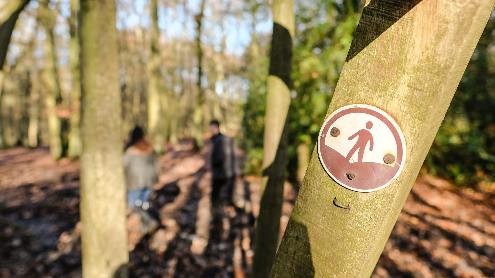
And we've got scarcely 5 years to identify them. We've found about 80,000km potential lost rights of way, which appear on historical maps as footpaths, roadways or even old country roads or lanes, as well as alleyways in towns and cities.

Now, we're not saying that all of those were definitely public rights of way, but they do represent potential routes. The test is: was something used by the public in the past? If so, then it should still be a right of way now.
The next stage is proving whether all these paths we’ve found were used by the public historically. And that's where the research comes in: it means getting volunteers to delve into the archives, to look at old maps or parish records, to prove that a path should be recorded.
Q: Has that been more tricky during COVID-19 where archives are not digitised?
JC: Yes. Although there is a useful chunk of research material that is already digitised, which is linked on our website, this is by no means comprehensive. There's a good deal of historical maps and records in local and national archives, that are still not online. So the pandemic has put a stop to that research really, for the past 6 months.
Q: Has COVID-19 made people more interested, though?
JC: We've definitely seen an uptick in terms of people going out walking. The other thing that the pandemic has brought home is the importance of that local network – walking isn't just about driving to a country park at the weekend or spending 4 or 5 days on a national trail, although both of those are fantastic.
The amazing thing is this hyper local network in England and Wales, most of which has already been legally recorded when the definitive map was drawn up. Most people have paths on their doorstep, and where they don't then that's an issue. And this is why we need to make sure a good chunk of these paths are back on the map.
Q: How aware is the general public of these paths?
JC: I think it varies. Obviously, with the publicity we've had we've seen an amazing number of people come forward to help, which has been fantastic. I think people do engage with the idea that a path network can be better, but also with the fact that these paths are part of our ordinary history. For me, they're as important as castles or monuments because they're how our ancestors engaged with the landscape.
And the other important thing is that, when we're talking about these unrecorded rights of way, some will be walked or cycled by people every day. But they're not recorded, so they don't have the level of protection that a recorded right of way has.
Some might be in the long memory of a village: "Oh, you used to be able to go up there." But some might have been completely forgotten, they might not have been walked for 100 years. And people strongly connect with this issue.
Q: So are you working with Ordnance Survey (OS), for instance?
JC: The Ramblers do have links with OS of course, but we're not directly working with the organisation at this stage. For the 80,000km we found, we have used OS maps though, both current and historic.
We're now working with organisations such as the National Trust and the Wildlife Trusts, as well as the British Horse Society, which has a keen interest in improving routes for riders. We've had conversations with Cycling UK, too, because this is not just about walking. And we're building a good relationship with parish councils and local authorities, which have an interest in the history of their communities and their improvement.
There are so many people who could be interested in this project as well if we could engage them, from the practical side of getting better access and improving communities to more detailed work around the heritage and history.
Q: What effect will recording rights of way have on rural areas?
JC: It will mean that our rights of way network makes much more sense. We won't have as many dead ends that stop in the middle of a parish boundary – which in real life may be in the middle of nowhere. We will have better access for everyone.
We've done some work recently on inequality of access, and how black and ethnic minority people have less access to green space. So we’re hoping to challenge some of that by adding better paths to the map. The issue of making the countryside accessible for all has been taken up in a podcast called Black Girls Hike, and we want to encourage and enable everyone to get out into wonderful landscapes.
This isn't necessarily just about beautiful walks in the Peak District. We think it's crucial to make sure that people have access to rights of way in towns and cities and suburbs as well, so instead of driving to the shops people can walk there. If you live in a housing estate or a suburban community, you need good access points to the countryside. You often see that you have to walk down an A-road to get into the countryside, even though you might live quite close to it.
There's also good evidence about how much walkers contribute to the rural economy every year. This is as a result of people having better access to farm shops and bed and breakfasts, all those places where agricultural businesses have diversified.
I think another benefit is that when people can access the countryside, it helps them understand how rural businesses work, and how farming works, which is a good thing. It gives people a much closer relationship with where their food comes from, for instance.
Obviously, some landowners may not want additional rights of way recorded on their land. It's important to emphasise that this initiative is not about creating rights of way, just recording what should have been recorded in the first place.
We're keen to work with landowners to add the paths that make the most difference, and to cooperate with them on diversions – most hikers don't want to walk through the centre of a farmyard, so we're happy to have a path around the edge of the field rather than right through the middle. We are quite pragmatic because for us it is about getting better walking opportunities. We're not necessarily fixated on having exactly the same path that was there 100 years ago.
Q: Are there any other benefits in recording the rights of way?
JC: The fundamental importance of recording a right of way is that this affords a level of protection and an expectation that the public can use it. Once a right of way is recorded, landowners and local authorities have to assume responsibility for maintaining it, clearing it of obstructions, and signposting. It also means that, eventually, the paths will be shown on an OS map as a right of way, so people actually know where they are.
Unless it is recorded, there is no legal recourse or way of enforcing that it be cleared. Similarly if someone wants to extend their home or to build a new housing estate, there isn't any legal protection for unrecorded paths as part of the planning process. So it isn't just a legal quirk, it has practical consequences for people.
Q: How can chartered surveyors help with this project?
JC: The next stage is getting individual paths applied for. This involves a volunteer putting together an application for a Definitive Map Modification Order – this application is essentially presenting the evidence that the path was used by the public in the past and therefore should be used by the public now. They make this case with historical documentary evidence. The skills that chartered surveyors have in terms of surveying, research, making an argument, could be hugely helpful. We’re only going to get these paths back on the map if people help us. So we’d welcome any RICS members, if they're interested, to let us know. We'd love to get their help.