Today, city modelling applications let us reconstruct cities virtually in a matter of hours, using 3D scanning and modelling. Various types of information can then be added to the resultant models to enable effective management of the built environment.
Although 3D modelling is an effective tool for documenting them at a given point in time, cities are never static. As the 2011 UNESCO Recommendation on the Historic Urban Landscape observes, cities are dynamic entities, laboratories of creativity, stimulated by their specific cultures and histories. They should be seen as adaptive systems that evolve while still retaining their respective identities.
To reflect this by allowing more efficient management of the built environment, an equally dynamic method of 3D modelling is needed. By doing so, we can use simulations to test the effectiveness of prospective planning scenarios and help develop appropriate strategies.
Procedural modelling
A technique known as procedural modelling can be used to generate 3D cities at the click of a mouse. Information feeds, analytical tools, age data, architectural knowledge and mathematical modelling can then be integrated into these virtual cities to test planning scenarios at a neighbourhood level and beyond.
Procedural modelling is a method used in computer science to create geometries from a set of rules. Director of the Esri R&D Center in Zurich Pascal Müller used the technique in 2008 to develop CityEngine, an application to build 3D urban environments that allows the development of complex, rule-based models and automatic and rapid generation of 3D cities. Fully dynamic 3D scenes can be produced and edited using simple controls, such as sliders and switches.
This makes CityEngine ideal not only for developing urban planning scenarios but also for generating cityscapes in films such as Blade Runner 2049 and digital re-creation of historic city environments using records and maps. This is particularly important for planners, as it can help them make better decisions, by creating simulations that help them understand the consequences of proposed design variations.
Dynamic period models
CityEngine can procedurally model a specific building typology, and uses age data and building footprints to populate a district such as Camden in London with dynamic models of a given period on a map.
The Victorian house case study was an experiment as part of my PhD, which tested the method using building age data from Colouring London, an innovative initiative that set out to map every building in London using crowdsourcing techniques. Through this process we developed a system that allows all Victorian buildings in Camden to be procedurally generated, creating a database of such buildings in 3D that can be readily adapted and updated.
This method is the first step in looking at historical buildings in the wider context of the contemporary city, using rule-based design to visualise scenarios that can be changed using different parameters such as building height, dimensions, extensions and percentage of demolitions. Although we began with the Victorian house, other typologies can be used to produce a responsive model of London.
In this case study we break down the form of the Victorian building into its main qualities, and explore the way building regulations relating to the Victorian house drawn up by central government to guide towns to formulate their own building bye laws can be used to generate rules for for 3D procedural models. Where regulations are deterministic, that is where they are detailed enough to determine an identifiable building type, the potential exists to produce rules that replicate the building typologies' form.
The Victorian house is the principal residential building typology of the period 1837 to 1901. Population growth between 1801 and 1851 drove the construction of millions of speculatively built houses, now a defining feature of London and other UK cities. With such rapid expansion came new building legislation which eventually led to a mass produced design of the Victorian terrace to accommodate rapid population growth, with byelaw terraced housing making up over 15% of the UK's housing stock in 2011.
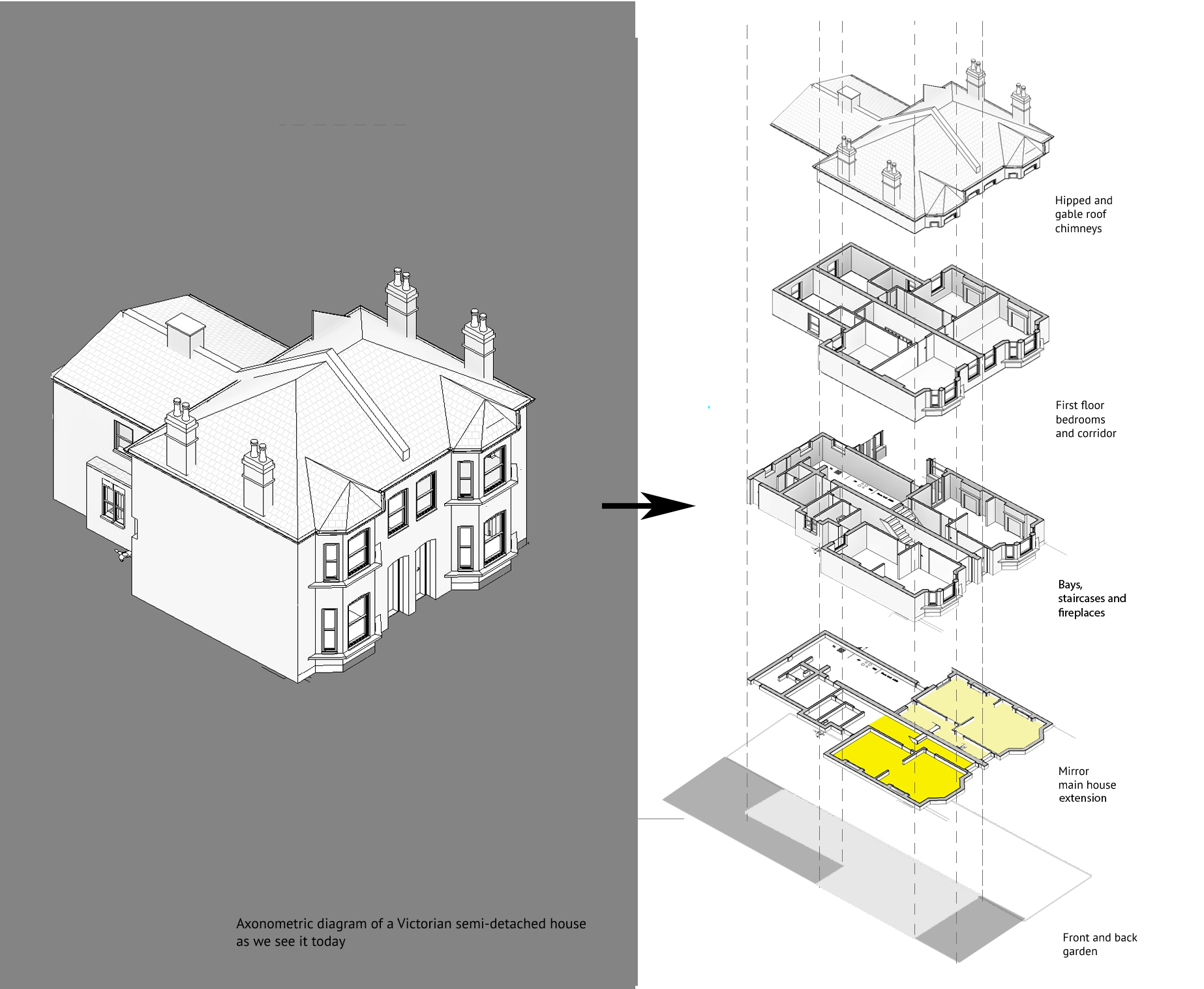
In CityEngine we created computer-generated architecture (CGA) rules to include such legislation insofar as it dictates form. For example, a common way to parametrise the volumes of the Victorian house is to define front yards as a set back relative to the street width, this would create a main building volume that is constrained by the width of the street.
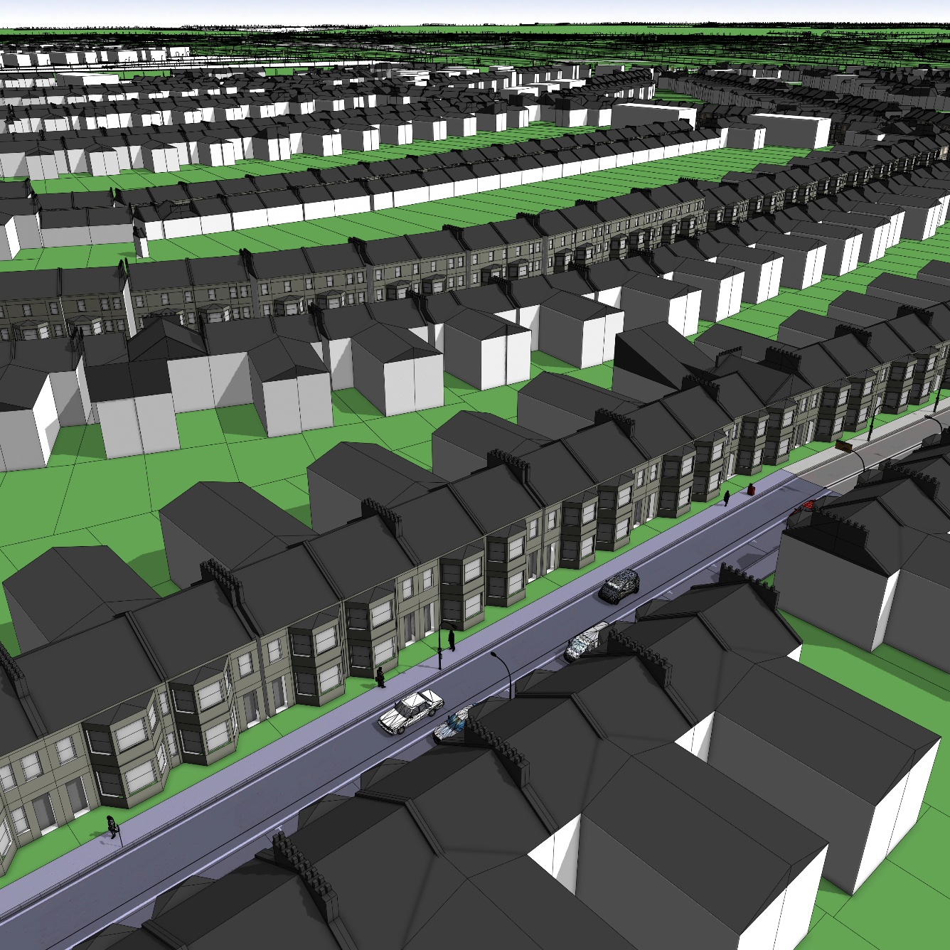
The building is also split in two volumes: the main building and the extension at the back. The extension can then have varying depth, based on the plot on which the sits. By integrating statistics of floor area ratios per block area, from the building age dataset, we are also able to create an approximate volume size for the generated buildings. Figure 2 shows how we can then also integrate a façade ruleset, which integrates basic rules for the morphology of the Victorian house.
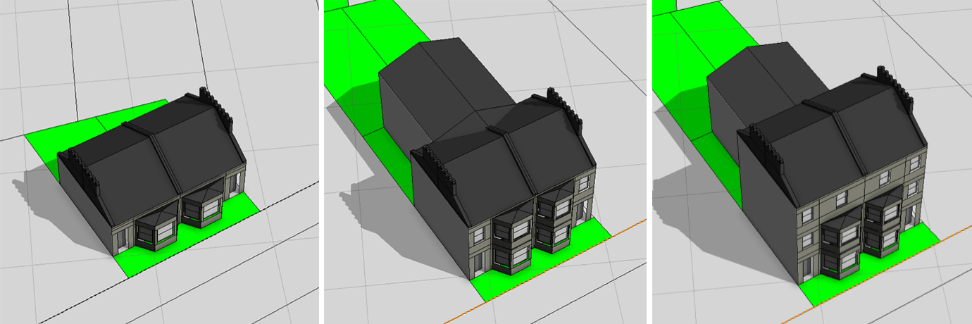
This method creates variations and not clones, so the generated building can be reconfigured according to different parameters. For example, you can create a variation by simply adjusting the height of the building without remodelling the whole house. Figure 2 shows an example of the same Victorian rule, applied in three different plots and with a maximum building height controlled by a single slider.
However, once a procedural typology is created, it is important that each variation is consistent. In addition to constraining it according to the relevant regulations, we needed a method to evaluate each generation to ensure consistency. For this, we implemented a blueprint system, originally developed by Hello Games to evaluate the procedurally generated worlds of the 2016 game No Man's Sky.
Viable variation
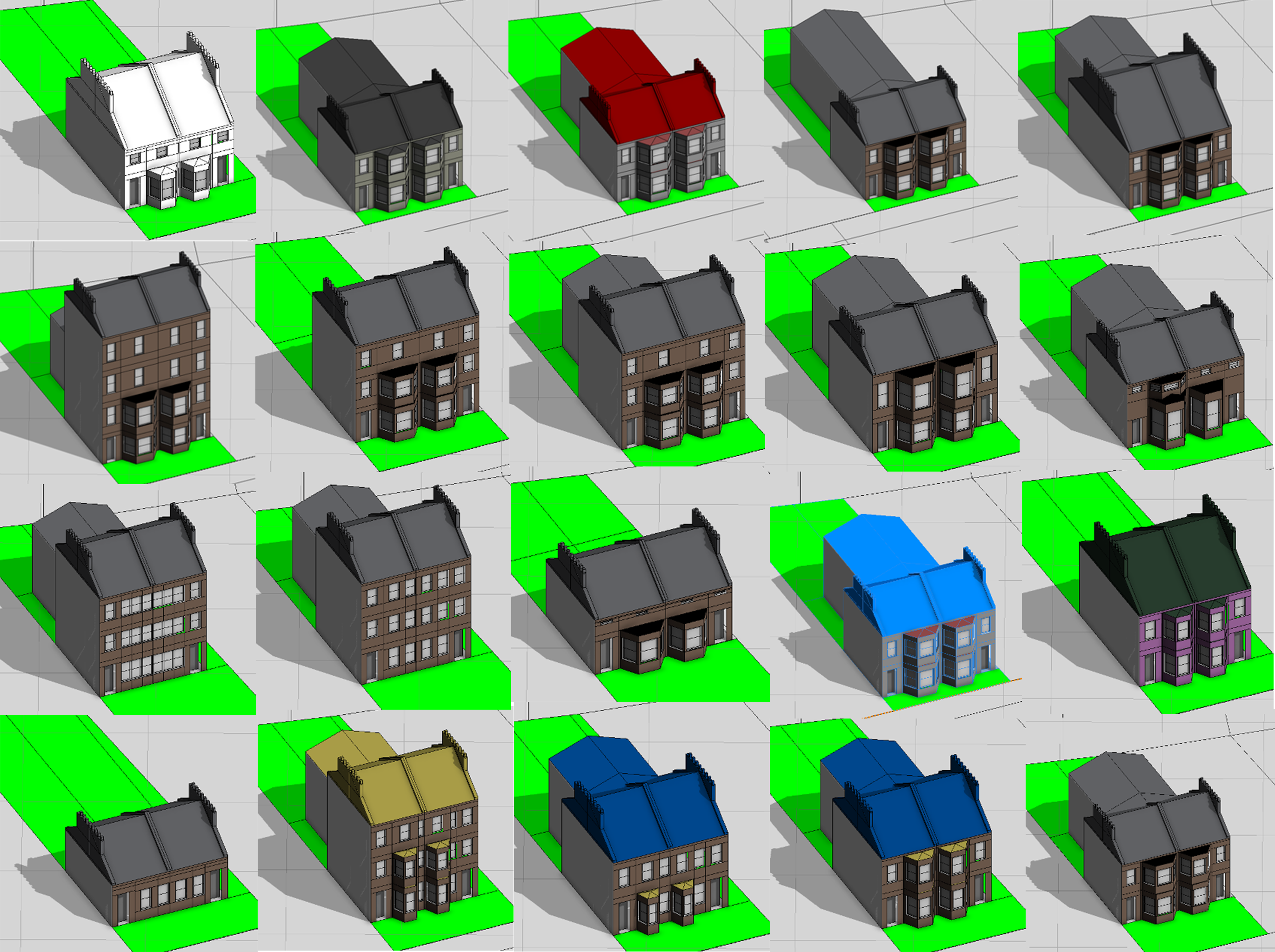
The system produces unlimited variations according to the rules by automatically modifying parameters and taking snapshots of each variation. Using these we could identify permutations that would not be encountered in real life. The exported models were then evaluated by eye and classified as viable or non-viable. We then refined the rules to prevent these being generated in future. For instance, the floor height of a Victorian house must range between 2.8m and 5.5m and a bay window has an angle of between 35° and 66°.
We used the road network from Open Street Map to generate streets and pavements, and were then able to generate zones with Victorian buildings procedurally for the area that is now the London Borough of Camden. The application automatically recognises the locations identified as Victorian terraced houses from age data in Colouring London and replaces volumes so tagged with the procedurally generated properties.
We took a mapped block of Camden made up of parcel polygons imported into CityEngine from HM Land Registry, with extruded volumes using footprint and height data from Colouring London. The procedure resulted in an approximate visualisation of the area of the same dimensions as the physical properties, the same number of houses, same coverage per parcel or block and same floor area ratios.
This method can be used to model large areas. For example, we can use the density slider to control the global percentage of Victorian houses in Camden to see what the borough would look like were new homes to be developed to the same specification, or if all the Victorian stock were demolished. Figure 5 illustrates what Camden would look like with 100% more Victorian buildings than it already has or none at all.
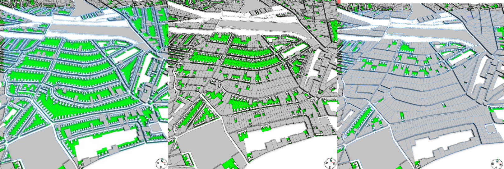
The advantage of such procedural planning is that it enables rapid development of 3D masterplans and city designs that can be directly edited using simple controls. The ability to alter generated elements, such as building envelopes or maximum heights, for multiple areas using sliders and switches means a range of different scenarios can be produced to test planning policies and regulations.
These applications could have a significant impact in urban heritage policy and practice because they offer an integrated view of the protected urban environment in future regeneration scenarios. These could be used to show, rapidly and at low cost, the planning implications of, for example, possible demolitions, highlighting the impact on the historic urban landscape, specific retrofit options for particular types of stock, or illustrating worst-case scenarios for areas before new planning regulations are introduced.
Employment environments
In addition, real-time simulations can also be integrated into the procedurally generated models. In the second case study, we combined generative sets of rules with a simulation that computes housing demand from employment projections.
By applying mathematical functions globally to the generated 3D urban environment, spatial relationships between economy and building density can be defined. Modelling urban scenarios in 3D like this suggests new ways to link the form and function of the city by visualising, analysing, exploring, and finally evaluating future plans through spatial analytics.
This second case study modelled all of South Yorkshire, including the city of Sheffield and town of Doncaster. Along with rules to define the urban environment, we tagged employment and housing indicators to the generated buildings.
An advanced urban simulation forecasts land-use patterns and population flow for South Yorkshire, calculating housing demand and services from employment projections that are integrated into the procedural system, to create housing scenarios.
The model can help planners by simulating and visualising the way the population and land uses in South Yorkshire may evolve in the next 20, 30 or even 50 years, depending on different employment scenarios.
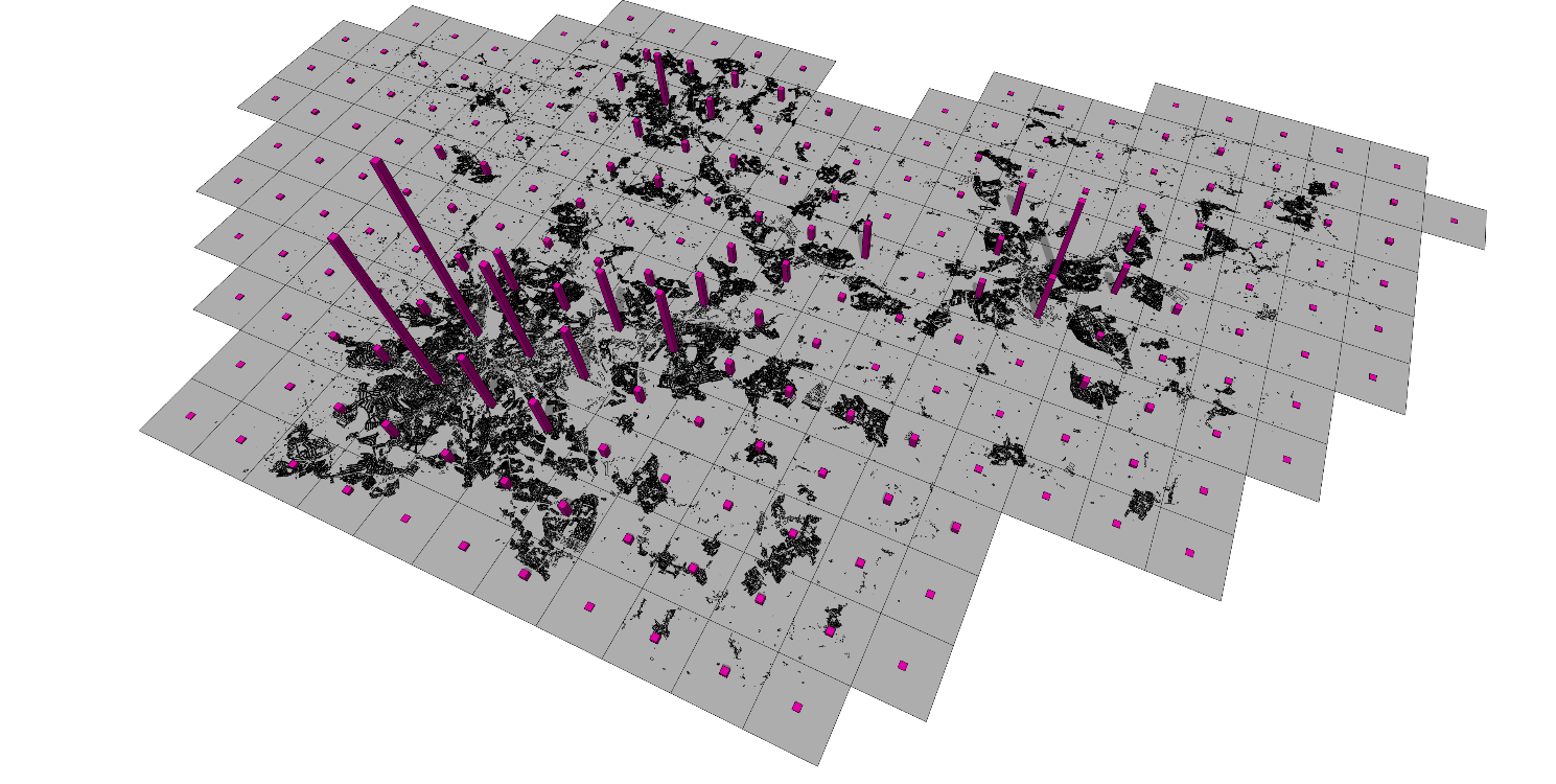
We used procedurally generated building volumes and land uses to calculate the rough housing capacity of residential zones and allocated population according to the projected figures from the simulation.
This method allows schematically designed building volumes and zone areas to be connected directly with modelling indicators such as population and housing provision, enabling the simulation to evaluate employment and housing planning scenarios in an area of interest.
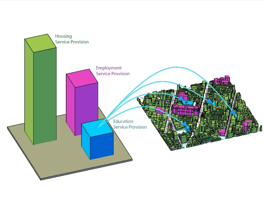
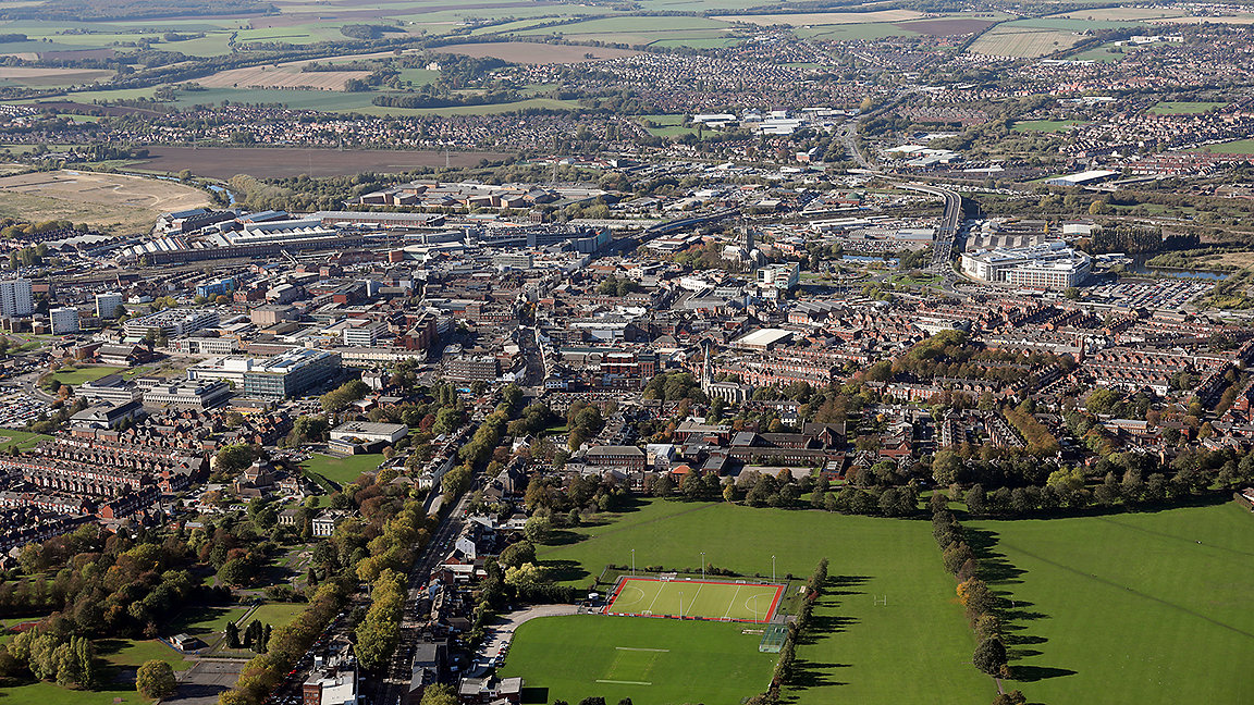
The result is an interactive 3D masterplan with design controls, and a simulation that provides a ready calculation of housing capacities and demand. Figure 8 shows a scenario in Doncaster with areas in red signifying potential housing demand, based on a prediction of increased employment in which the university expands.
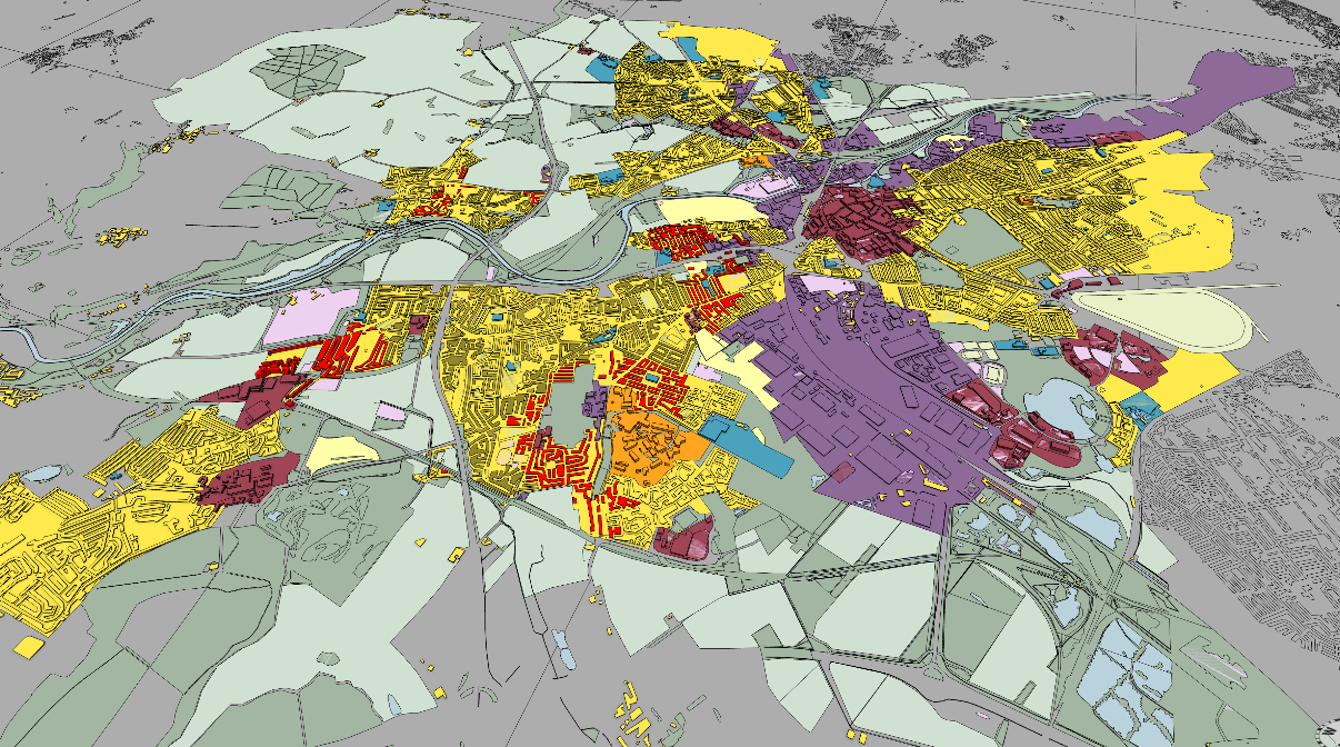
This combination of dynamic visualisation and urban analytics can offer a new paradigm for creating masterplans where science and design can be integrated into one platform to model multiple possible scenarios.
Can analytics and simulations help planning?
In the form of these case studies, procedurally generated models are already helping with planning. The discipline would certainly benefit from data analysis and modelling, as demonstrated by recent interest from large planning consultancies such as Buro Happold and HOK, along with the turn towards implementing urban modelling in regional planning using bespoke, in-house applications. But does it have the capacity to change planning as a process?
Procedural development of scenarios challenges the planning process by producing an infinite rather than finite number of proposals. At the moment, this is only being used as a sketching mechanism by planning firms as CityEngine is still a useful tool to produce early designs quickly, evaluate these and present them to clients.
However, the potential of this method goes much further. If we assume that there is not one single solution to the planning problem, then there must be numerous variations of optimal solutions that can be produced and to better fit the needs of the community. In this case the procedure may challenge the authority of the masterplan by instead offering dynamic online systems that can be altered over time, either with input from users – including the public – or as new developments are constructed over the years.
The methodology can allow planners to think more broadly in terms of properties or qualities, capacities and parameters rather than finite design outputs. This is a different way of implementing urban planning in practice, which is closer to policymaking.
The tools then enable quicker understanding of the implications of applying land use and population metrics in a defined boundary, while acknowledging existing site constraints and communicating interactive scenarios to a wider audience.
Dr Flora Roumpani is a research associate at the Alan Turing Institute and visiting lecturer at the RCA
Contact Flora: Email
Related competencies include: GIS (geographical information systems), Spatial planning policy, Surveying and mapping
