%20Patrick%20Bingham%20and%20Hassel-May%202021_Flooding%20listicle_Modus?$article-big-img-desktop$&qlt=85,1&op_sharpen=1)
Photo: Patrick Bingham-Hall/Hassell
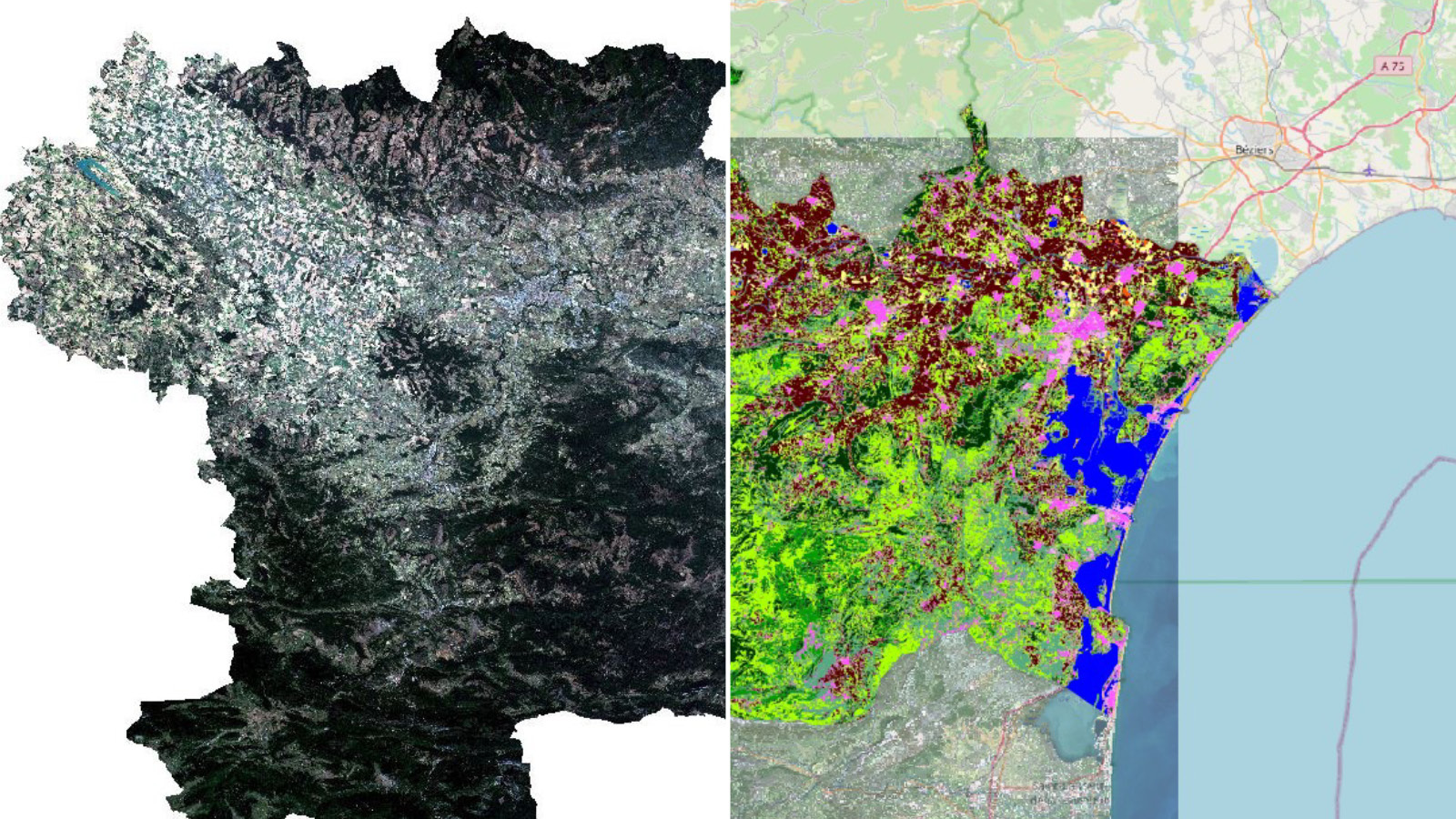
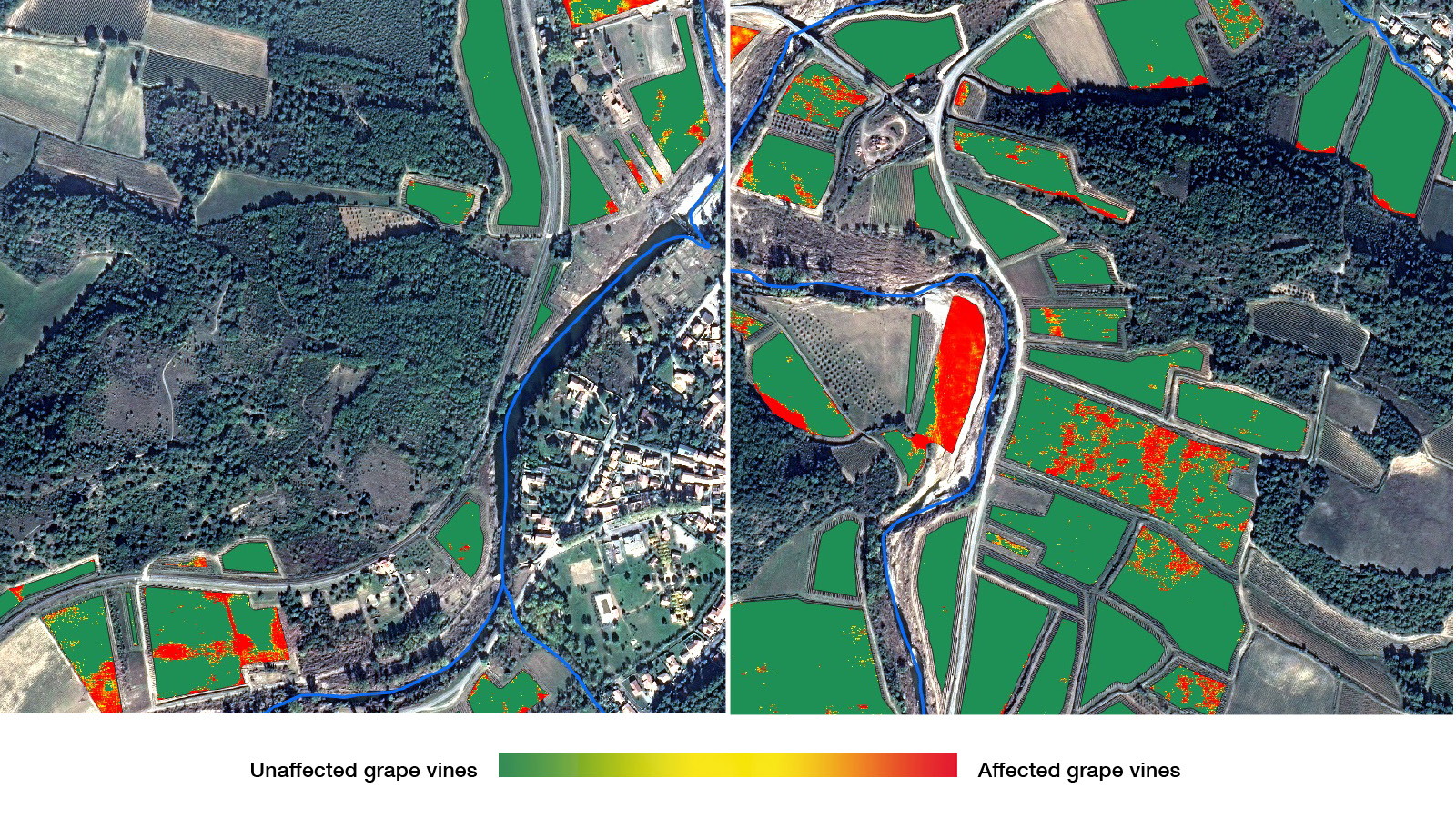
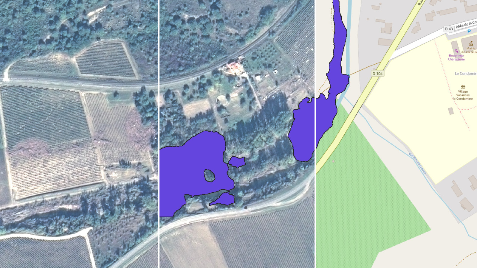
Images: CNES, Pléiades @ CNES 2018, Distribution Airbus DS, CNES, DDTM11, SGEvT, Météo France, and Université Toulouse Jean Jaures
Satellite imagery showing flood risk areas, potential impact on vineyards and a flood map being built
SATELLITE IMAGING FLAude (France)
After devastating floods in 2018 in the Aude area of France, the local environment department began working with the French space agency CNES and the EU’s Copernicus Earth observation programme to see how satellite images could be used to assess the damage. The team built an AI algorithm to identify potentially dangerous log jams and pinpoint where the removal of hedgerows has led to dangerous run-off. The goal is to create tools for local authorities to make better planning decisions that will limit damage from flooding.
Photos: Max Creasy/Hassell
The Victoria Park basin project – Sydney’s stealth weapon against stormwater
LAND USE Victoria Park (Sydney, Australia)
Land use and appropriate handling of stormwater is a crucial tool in reducing flooding. The Victoria Park development in Sydney designed by Hassell, completed in 2002, was a forerunner in using natural methods to slow, store, and drain floodwater.
The area was swampy and prone to flooding and the park is designed to absorb much of the local rainfall, to prevent nearby residences from flooding. The whole park was lowered to act as a basin and bio-swales, or vegetated channels, absorb water and keep it off roads. Stormwater is filtered through the plants and soils of the swales, and heavy rainfall is directed towards an underwater storage basin, edged by a stormwater canal.
The whole park was lowered to act as a basin and to absorb much of the local rainfall

The Thames Flood Barrier
INSURANCE DEFRA Property Flood Resilience Database (UK, nationwide)
DEFRA is driving the creation of a database that scores flood resilience measures per property. The goal is to help home and business owners to get insurance policies that reflect their property’s specific risk, rather basing it on a regional flood map. It could make policies more affordable for those who have reinforced their property and ensured they can recover quickly.
“At the moment, you’d need to make an individual case to an insurer that you’ve made yourself more resilient,” says Ian Gibbs MRICS, national technical manager at Sedgwick International UK, and vice-chair of the DEFRA Flood Resilience Roundtable. “But insurers need evidence, they need that in a database, and they need it to be simple.”
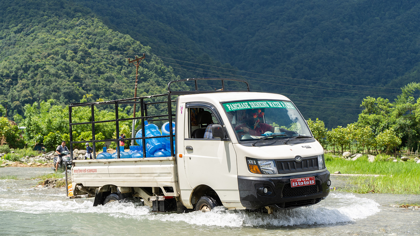
Residents battle through the floods in Nepal
EARLY WARNING SYSTEMS Solar-powered warning system in Berichaal Chepang, Nepal
Mountainous Nepal is frequently hit by floods. The Bheri River floods to an “extreme” level every 10 years; in 2014, a flood and subsequent landslides killed more than 100 people and destroyed the property of thousands of people. Renewable World worked with Nepal’s government to install a solar-powered early warning system at the downstream community of Berichaal Chepang. Whenever water levels upstream on the Bheri river reach a dangerous level, flood warnings are sent out via the internet, display boards, and SMS. The local community, or the department of hydrology, can then trigger a siren that allows residents around three hours to prepare and evacuate.

%20Max%20Creasy%20and%20Hassel-May%202021_Flooding%20listicle_Modus.jpg)
%20Max%20Creasy%20and%20Hassel-May%202021_Flooding%20listicle_Modus.jpg)
%20Max%20Creasy%20and%20Hassel-May%202021_Flooding%20listicle_Modus.jpg)
%20Max%20Creasy%20and%20Hassel-May%202021_Flooding%20listicle_Modus.jpg)
