Culverts, buried utilities, mine-shafts, sinkholes and underground chemical tanks – just a handful of the hazards and obstacles hidden from conventional surveying but all too ready to delay or even halt infrastructure projects. If undetected, these hazards can result in health and safety implications, workforces being temporarily laid off and financial plans left in tatters.
Enter quantum technology. Automated equipment has long aided chartered surveyors in locating obstacles and now the question is how quantum technology can enhance existing practices. Dr Nicole Metje, Birmingham University’s professor of infrastructure monitoring, points out that many current technologies transmit electromagnetic waves through the ground; they are reflected off buried objects and the consequent reflected wave is received at the surface. However, circumstances such as wet clay all too often reduce or prevent signals penetrating deep into the ground.
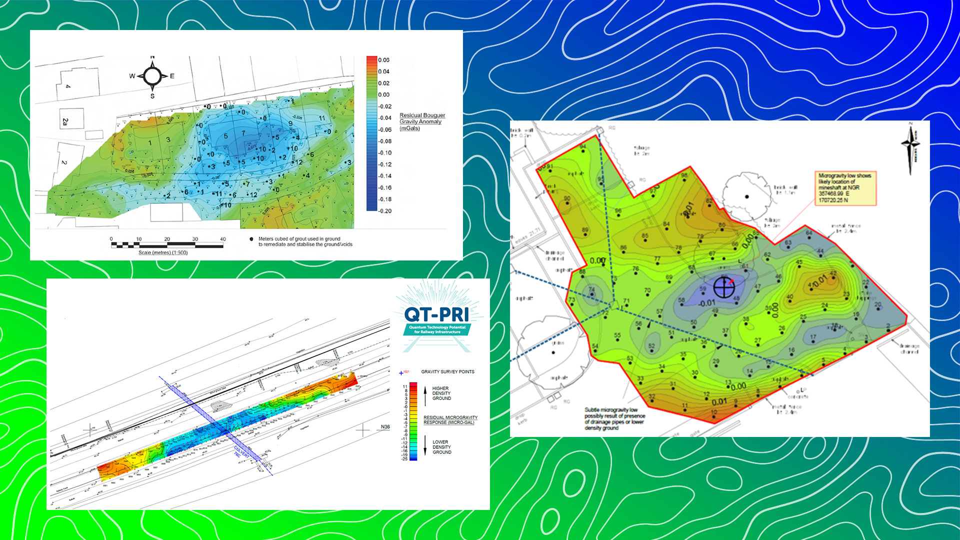
Quantum technology applies a technique called atom interferometry: sensing how fast atoms drop in a vacuum chamber, which wards off distortions such as surrounding noise during the measurement process. Gravity signatures from the objects in question then build up accurate depictions of the infrastructure.
Uniting highly advanced skills
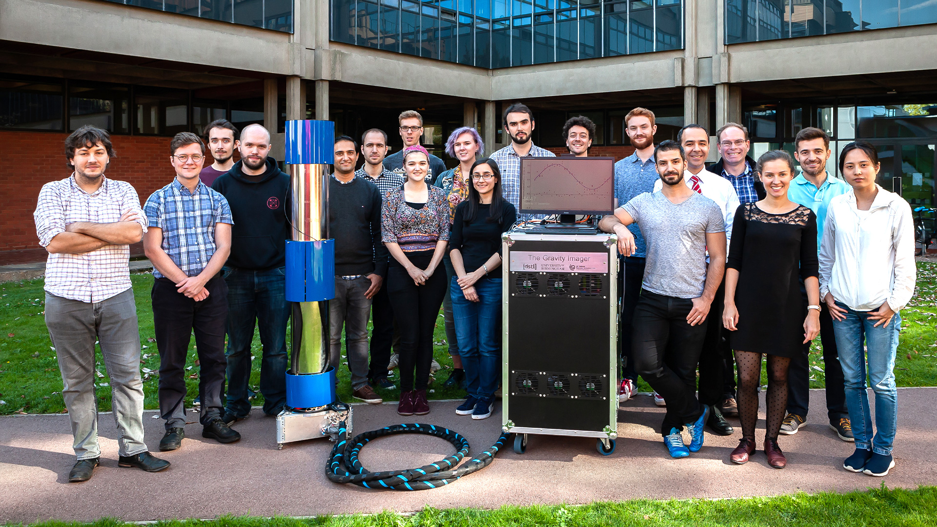
Led by Birmingham University, the UK National Quantum Technology Hub in Sensors and Timing brings together physics and engineering specialists from several universities, the National Physical Laboratory, the British Geological Survey and over 70 industry partners. At present, 100 projects are in progress, uniting expertise in physics (for creating an advanced quantum technology sensor) and civil engineering (to ensure that the finished system meets demanding conditions).
Prominent in developing this technical side is another Birmingham University professor, Kai Bongs, who holds the post of chair in cold atoms. As principal investigator of the Hub, he explains that “while we are all already using technology based on quantum mechanics, in particular the transistor and the laser, and this is underpinning the IT sector, we are now harnessing more advanced effects. This new quantum technology, which has attracted great excitement and worldwide investments exceeding $20bn, concerns the possibility of harnessing quantum technology effects by controlling individual quantum particles.”
Customer interest
The Hub’s research and findings have attracted interest from both public and private sectors. Metje expands on this: “We work closely with industry, asset owners and local authorities to maximise the potential of the technology and increase uptake once it is ready for commercialisation. This interaction also ensures we are creating an instrument fit for purpose by involving all the relevant stakeholders early on during the development. Often local authorities give planning permissions, but it could be the land owner or asset owner. Utilities have the right to work in the streets on their assets but local authorities can charge them lane rental to occupy the space.”
Bongs adds: “We liaise with both the public and private sectors in order to get a holistic view of the project and ensure it has a sustainable impact. The coherent and coordinated action of industry, government and academia is a key ingredient to the UK quantum programme.”
In addition, Dr George Tuckwell, director of environmental and engineering consultants RSK Group, brings a commercial perspective: “It depends on the scope of the project. Our role in developing quantum technology is as the ‘end user’, so we liaise closely both with those very clever people developing the components and systems of a quantum instrument, and also with our clients. We are the go-between that seeks to match what the marketplace would want an instrument to be capable of with the physicists and engineers developing the hardware, so that we get a commercially viable and exciting result.
“Project partners range from University of Birmingham, which is pioneering the quantum physics, to Teledyne e2v, which is building a commercial instrument, and Fraunhofer, which is developing laser components. There’s also HS2, Network Rail and The Coal Authority, and the Canal and River Trust who are interested in having the ground mapped more accurately.”
Bongs states that roughly 25% of quantum technology projects are linked internationally, mainly through European funding, while the RSK figure is approximately 30% outside the UK and growing rapidly.

“Quantum technology gravity sensors […] help us increase our confidence about the subsurface environment and reduce the risks of unknowns.” Dr Nicole Metje
The technology
“Our quantum sensors are based on atoms as probe particles,” says Bongs. “We are using atom interferometers, configured in a way to provide a precise measurement of gravity gradients. This removes the bottleneck of ground vibrations and promises fast gravity measurements in the future.”
Tuckwell continues: “Our primary focus of activity has been on the development of gravity measuring instruments. In any construction project the greatest risk lies in unforeseen ground conditions and there is a big market for a new and improved way of mapping the ground.
“We use both developing quantum instruments and existing geophysical surveying technologies, together with other sensors which provide environmental data, for example ground vibrations, magnetic fields and temperature, which affect the instruments.
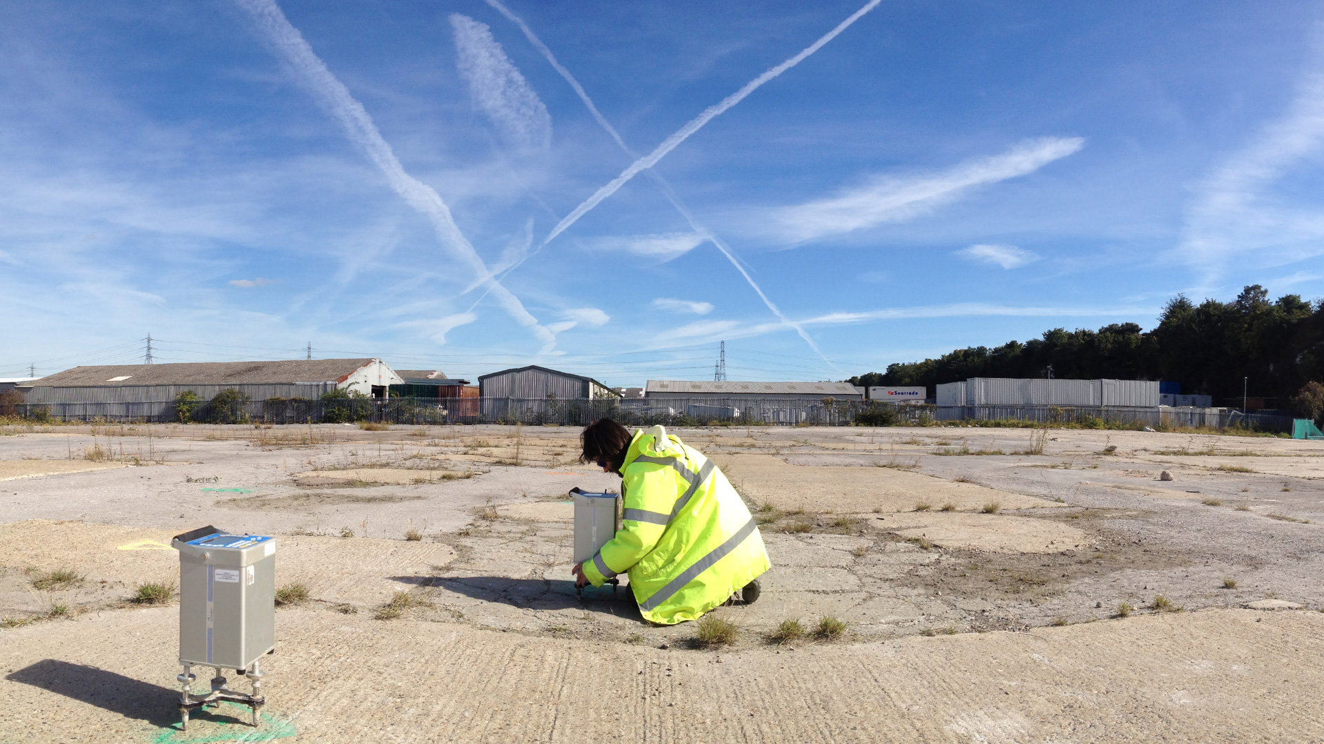
“We have pushed an agenda of ensuring instruments that are developed are tested outside the lab, in field conditions. This highlights weaknesses and issues that would not otherwise appear, and also allows for a direct like-for-like comparison with existing geophysical instruments in realistic conditions.”

“This new quantum technology has attracted great excitement and worldwide investments exceeding $20bn.” Professor Kai Bongs
The results
Bongs stresses that the UK’s West Midlands has become an international hotspot in the development of quantum sensors – potentially up to 10% of global quantum sensor activities are linked to the Hub: “We have the regional support programmes CIAMM (Centre for Innovation based on Advanced Measurements in Manufacturing) and QTIH (Quantum Technology Innovation Hub) funded by the Greater Birmingham and Solihull Local Enterprise Partnership in which we have provided quantum sensor advice to more than 30 local SMEs and we are starting to attract larger companies into the area. It is still early days, but we are seeing the growth of an emerging ecosystem.”
Continuing the West Midlands theme, Metje says: “From a civil engineering viewpoint, old mine-shafts such as the ones we find in the Black Country are mapped poorly and at sizes of 1-2m in diameter and 5-10m in depth to the top of the shaft are very challenging for existing geophysical sensing technologies. Similarly, solution features of these dimensions can be difficult.
“The challenge is often also related to ground conditions, which are less of an issue for gravity sensors than other geophysical sensors relying on electromagnetic waves propagating through the ground. For me, the key is that quantum technology gravity sensors are another tool which complements existing tools and helps us increase our confidence about the subsurface environment and reduce the risks of unknowns.”
The future of quantum sensors
Looking ahead, Bongs says: “In principle there is no limit to the depth at which quantum sensors for gravity will see underground density variations. However, this becomes a question of time taken to do the measurement. Detecting 1-2m diameter mine-shafts at 10m depth, measuring on a grid with 10 minutes per measurement point will be feasible soon, using optimisation of our current demonstrator instrument. The next stage of ‘quantum tricks’ for sensitivity improvements could get this to 30 minutes, with 10 seconds per measurement point within a few years – at which point you could imagine flying a drone over an area to de-risk it.
“Quantum sensors promise to add another tool to the underground surveying toolkit, which will allow the assessment of risks associated with large-scale deep objects.”
George Tuckwell believes that while his sector is yet to have a commercial instrument in its hands, developing the technology has raised RSK’s profile as key players in its field. This has also been valuable for young bright staff to become involved in R&D, with the opportunity to learn new skills while bringing their experience of real-life commercial surveys.
Bongs summarises the huge value of being able to accurately map what’s underground from above ground: “Unknown underground conditions are the largest single risk in infrastructure projects, having an impact of 0.5% of GDP in terms of cost overruns and delays. Being able to see into the ground using quantum sensors not only promises to identify risks arising from past activity, but also promises to identify the location of the best underground conditions for future developments. They increase our ability to use the underground for the sustainable development of our cities.”
Unknown underground conditions are the largest single risk in infrastructure projects


